Category:Files with coordinates missing SDC location of creation (52° N, 1° W)
Media in category "Files with coordinates missing SDC location of creation (52° N, 1° W)"
The following 200 files are in this category, out of 1,192 total.
(previous page) (next page)-
 "OILSKI TURNED OFFSKI" Old Warden, 08-5-2016 (31077546722).jpg 2,719 × 3,443; 4.15 MB
-
 -2020-10-30 South Street, Bourne, Lincolnshire.jpg 6,252 × 4,164; 4.38 MB
-
 -2020-10-30 West Street, Bourne, Lincolnshire.jpg 6,154 × 4,015; 3.35 MB
-
 -2021-02-15 Looking south along Beech Avenue, Bourne.jpg 3,024 × 4,032; 3.99 MB
-
 -2021-11-16 Beech Avenue, Bourne, Lincolnshire.jpg 3,072 × 4,080; 4.98 MB
-
 -2022-06-03 Duddington Bridge, Northamptonshire.jpg 6,252 × 4,164; 7.27 MB
-
 -2022-10-01 Trees in Bourne wood, Bourne, Lincolnshire.jpg 3,072 × 4,080; 6.28 MB
-
 -2022-10-08 View from Bourne wood, Lincolnshire.jpg 4,080 × 3,072; 5.45 MB
-
 -2022-11-14 Looking along a footpath, Bourne, Lincolnshire.jpg 3,072 × 4,080; 5.17 MB
-
 -2022-11-16 Laurel Tree, Bourne wood, Lincolnshire.jpg 3,072 × 4,080; 6.63 MB
-
 -2022-12-01 Santa Clause, Beech Avenue, Bourne, Linconshire.jpg 4,080 × 3,072; 2.75 MB
-
 -2023-01-08 The spire, Parish church of St Mary & St Nicholas, Spalding, Lincolnshire.jpg 4,067 × 6,190; 7.47 MB
-

-
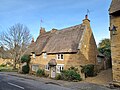
 -2023-01-09 Timber framed house, Cowl Street, Evesham.jpg 1,600 × 1,200; 355 KB
-
 -2023-02-21 Tractor and Trailer, Bourne Wood, Lincolnshire.jpg 1,600 × 1,205; 1.03 MB
-
 -2023-02-21 Tractor, Bourne Wood, Lincolnshire.jpg 1,600 × 1,205; 820 KB
-
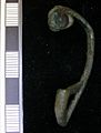 05dd06 -roman colchester style brooch (FindID 104293).jpg 827 × 1,089; 152 KB
-
 08 809 brings the empties up the Ketton Cement branch - 51252729771.jpg 5,419 × 2,731; 1.54 MB
-
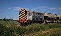 08 809 brings the empties up the Ketton Cement branch.jpg 5,263 × 3,109; 1.61 MB
-
-
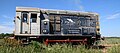
 08 809 with the Ketton Cement plant in the background.jpg 3,955 × 1,837; 1.05 MB
-
 08809 in RMS Locotec scheme, Ketton cement branch.jpg 4,837 × 2,155; 1.14 MB
-
 1, West Street, Bourne 01.jpg 3,000 × 4,000; 5 MB
-
 1, West Street, Bourne 02.jpg 4,000 × 3,000; 4.82 MB
-
 10 Barn Hill.jpg 3,072 × 4,080; 5.97 MB
-
 10 Bedford Street, Ampthill.jpg 4,128 × 3,096; 2.5 MB
-
 10 Brownlow Street, Grantham (geograph 7338669).jpg 1,024 × 742; 178 KB
-
 10 Churchgate, Hallaton.jpg 4,000 × 3,000; 2.93 MB
-
 10 Common Street, Ravenstone.jpg 4,000 × 3,000; 4.03 MB
-
 10 Main Street, Caldecott (geograph 7170359).jpg 1,024 × 768; 244 KB
-
 10 Market Place, Whittlesey (geograph 7193362).jpg 1,024 × 768; 174 KB
-
 10 Middle Street, Elton (geograph 6311860).jpg 1,024 × 768; 148 KB
-
 10 Red Lion Street.jpg 3,072 × 4,080; 3.29 MB
-
 10 St Mary's Hill.jpg 3,072 × 4,080; 5.9 MB
-
 10 St Mary's Street.jpg 3,072 × 4,080; 3.3 MB
-
 10 St Peter's Street.jpg 4,080 × 3,072; 4.84 MB
-
 10-12 The Causeway, Godmanchester (geograph 6942125).jpg 1,024 × 768; 175 KB
-
 1009 Wolverton "Bloomer" LNWR 2-2-2 replica at MK Museum.jpg 5,107 × 2,983; 1.64 MB
-
 11 and 12 St Mary's Hill.jpg 4,080 × 3,072; 4.11 MB
-
 11 and 12 St Mary's Street.jpg 4,080 × 3,072; 4.1 MB
-
 11 Austin Street.jpg 4,080 × 3,072; 4.89 MB
-
 11 Chadley Lane, Godmanchester (geograph 6942546).jpg 768 × 1,024; 184 KB
-
 11 Church Way, Little Stukeley (geograph 6929424).jpg 1,024 × 768; 158 KB
-
 11 College Street, East Bridgford.jpg 1,280 × 960; 523 KB
-
 11 Common Street, Ravenstone.jpg 4,000 × 3,000; 3.54 MB
-
 11 Park Road, Swinstead (geograph 6839545).jpg 1,024 × 811; 180 KB
-
 11 St Martin's.jpg 4,080 × 3,072; 4.53 MB
-
 11 Stamford Road, Weldon (geograph 7283158).jpg 1,024 × 792; 169 KB
-
 111 High Street, Huntingdon (geograph 6935603).jpg 1,024 × 768; 198 KB
-
 12 All Saints Street, Stamford.jpg 3,072 × 4,080; 3.48 MB
-
 12 and 14 Nottingham Road, Cropwell Bishop.jpg 1,280 × 960; 339 KB
-
 12 Church Street, Baston (geograph 6989012).jpg 1,024 × 739; 135 KB
-
 12 Church Street, Boughton, Northamptonshire.jpg 4,000 × 3,000; 4.03 MB
-
 12 Dunstable Street, Ampthill (October 2023).jpg 2,957 × 2,218; 1.89 MB
-
 12 Main Street, Ayston (geograph 7279354).jpg 1,024 × 768; 293 KB
-
 12 Main Street, Preston (geograph 7291498).jpg 1,024 × 825; 197 KB
-
 12 Middle Street, Elton (geograph 6311864).jpg 1,024 × 768; 145 KB
-
 12 Rectory Lane, Glinton (geograph 6994905).jpg 1,024 × 768; 169 KB
-
 12, West Street, Bourne.jpg 4,000 × 3,000; 971 KB
-
 120-124 High Street, Ramsey (geograph 5843043).jpg 3,264 × 2,448; 2.74 MB
-
 12A, 12B and 13 Post Street, Godmanchester (geograph 6942145).jpg 1,024 × 768; 173 KB
-
 13 and 14 Church Street, Boughton, Northamptonshire.jpg 4,000 × 3,000; 3.65 MB
-
 13 Barn Hill.jpg 4,080 × 3,072; 3.59 MB
-
 13 High Street, Stamford.jpg 3,072 × 4,080; 3.64 MB
-
 13 St Mary's Hill.jpg 4,080 × 3,072; 6.42 MB
-
 136 High Street, Huntingdon (geograph 6942669).jpg 1,024 × 768; 163 KB
-
 138 High Street, Huntingdon (geograph 7383046).jpg 1,024 × 768; 186 KB
-
 14 All Saints Street, Stamford.jpg 4,080 × 3,072; 4.11 MB
-
 14 and 16, West Street, Bourne.jpg 4,000 × 3,000; 1.07 MB
-
 14 Austin Street.jpg 4,080 × 3,072; 4.06 MB
-
 14 Barn Hill.jpg 4,080 × 3,072; 3.26 MB
-
 14 Main Street, Preston (geograph 7291501).jpg 1,024 × 768; 207 KB
-
 14 Spot ladybird - Propylea quatuordecimpunctata (35703491871).jpg 3,107 × 1,557; 3.02 MB
-
 14 The Causeway, Godmanchester (geograph 6937055).jpg 1,024 × 768; 148 KB
-
 14 to 17 High Street, Stamford.jpg 4,080 × 3,072; 5.22 MB
-
 14 West Street, Oundle (geograph 6544653).jpg 1,024 × 768; 164 KB
-
 14, 15 and 16 Common Street, Ravenstone.jpg 4,000 × 3,000; 2.94 MB
-
 15 Church Street, Boughton Northamptonshire.jpg 4,000 × 3,000; 3.31 MB
-
 15 St Peter's Street.jpg 4,080 × 3,072; 4.67 MB
-
 15 The Causeway, Godmanchester (geograph 6937051).jpg 1,024 × 768; 158 KB
-
 15, North Street, Bourne.jpg 4,000 × 3,000; 1,004 KB
-
 151 High Street, Huntingdon (geograph 6943290).jpg 768 × 1,024; 234 KB
-
 152 High Street, Huntingdon (geograph 7383367).jpg 1,024 × 768; 122 KB
-
 153357 at Peterborough.jpg 4,234 × 2,812; 2.78 MB
-
 153366 at Bedford 2012-02-04.jpg 4,070 × 2,705; 6.07 MB
-
 158773+158864 at Grantham.jpg 3,856 × 2,561; 2.36 MB
-
 158785 Werrington Junction.jpg 2,029 × 1,061; 451 KB
-
 158799 Werrington JUnction.jpg 2,729 × 1,673; 829 KB
-
 158806 Kings Dyke 110822.jpg 3,805 × 2,407; 2.64 MB
-
 158810 Werrington Junction.jpg 3,766 × 3,221; 1.89 MB
-
 158864 Departs Grantham for Norwich.jpg 4,288 × 2,848; 3.38 MB
-

-
 16 and 20 Fern Road, Cropwell Bishop.jpg 1,024 × 768; 167 KB
-
 16 Barn Hill.jpg 4,080 × 3,072; 4.59 MB
-
 16 Church Street, Oakham.jpg 4,000 × 3,000; 2.86 MB
-
 16 Church Street, Weldon (geograph 7281430).jpg 1,024 × 768; 159 KB
-
 16 Churchgate, Hallaton (geograph 7284898).jpg 1,024 × 768; 176 KB
-
 17 and 19 Welham Road, Great Bowden.jpg 4,000 × 3,000; 4.75 MB
-
 17 Burley Road, Oakham (geograph 7335863).jpg 1,024 × 741; 99 KB
-
 17 High Street, Morcott (geograph 7378145).jpg 1,024 × 768; 253 KB
-
 17 Northgate, Oakham 01.jpg 4,000 × 3,000; 3.05 MB
-
 17 Northgate, Oakham 02.jpg 4,000 × 3,000; 3.5 MB
-
 17 Post Street, Godmanchester (geograph 6943312).jpg 1,024 × 792; 173 KB
-
 17 St Mary's Street.jpg 3,072 × 4,080; 3.77 MB
-
 17 to 21 St George's Street.jpg 4,080 × 3,072; 3.87 MB
-
 17,18 The Causeway, Godmanchester (geograph 6937047).jpg 1,024 × 767; 149 KB
-
 170 636 Ketton SB.jpg 1,930 × 1,275; 696 KB
-
 170113 Ketton SB.jpg 2,401 × 1,501; 626 KB
-
 170397 at Peterborough.jpg 4,288 × 2,848; 3.32 MB
-
 170532 East Midlands Railway livery Werrington Junction.jpg 3,951 × 2,646; 2.02 MB
-
 170619 Birmingham-Stansted service at Werrington Junction 160621.jpg 4,657 × 1,969; 1.68 MB
-
 170619 Werrington Junction 2.jpg 4,105 × 2,317; 1.25 MB
-
 170636 Ketton Outer Home.jpg 2,631 × 1,571; 861 KB
-
 17th century barn (geograph 7448365).jpg 6,252 × 4,164; 7.53 MB
-
 18 and 19 High Street, Stamford.jpg 4,080 × 3,072; 3.65 MB
-
 18 Church Street, Oakham.jpg 3,000 × 4,000; 2.84 MB
-
 18 St Mary's Street.jpg 3,072 × 4,080; 3.74 MB
-
 18, North Street, Bourne.jpg 4,000 × 3,000; 1.06 MB
-
 18, West Street, Bourne.jpg 4,103 × 3,138; 1.08 MB
-
 180101 Grand Central Trains at Werrington Junction.jpg 4,686 × 3,331; 2.71 MB
-
 180104 Grand Central Trains Andelante Offord Cluny.jpg 4,381 × 1,901; 1.86 MB
-
 180107 Grand Central Trains at Werrington Junction.jpg 2,806 × 1,766; 710 KB
-
-
 Neale(1818) p2.274 - Belton House, Lincolnshire.jpg 1,808 × 1,270; 563 KB
-
 18th century cottage (geograph 7386557).jpg 5,906 × 4,024; 7.78 MB
-
 18th century houses (geograph 6821194).jpg 6,252 × 4,164; 3.57 MB
-
 1906 Hornsby 9HP oil engine.jpg 4,645 × 3,703; 2.21 MB
-
 1906 Merryweather Fire Engine from Newport Pagnall.jpg 3,577 × 3,733; 1.64 MB
-
 1910 Bristol Boxkite (8250568584).jpg 2,112 × 2,816; 766 KB
-
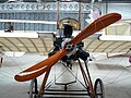 1910 Deperdussin (8250567038).jpg 2,816 × 2,112; 812 KB
-
 1914-1918 War Memorial, Market Harborough (geograph 6819239).jpg 768 × 1,024; 138 KB
-
 1917 Royal Factory SE5A (8249503487).jpg 2,816 × 2,112; 715 KB
-
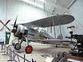 1935 Gloster Gladiator (8249528141).jpg 2,816 × 2,112; 621 KB
-
 1936 DH Dragon Rapide (8249537065).jpg 2,816 × 2,112; 655 KB
-
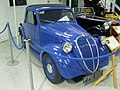 1937 Fiat Topolino, The Shuttleworth Collection. (12020411784).jpg 3,648 × 2,736; 1.5 MB
-
 1938 - Triumph Dolomite - DDU 658 (8037101873).jpg 2,563 × 3,921; 871 KB
-
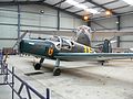 1940 Bucker Bestmann (8250603902).jpg 2,816 × 2,112; 702 KB
-
 1971 Austin Kimberley.jpg 907 × 530; 521 KB
-
 25.05.85 Wellingborough 43069 (6710342279).jpg 1,515 × 997; 206 KB
-
 1993 Daihatsu Charade Turbo Diesel.jpg 2,289 × 1,356; 726 KB
-
 2017 Alfa Romeo 4C Spider TBi.jpg 2,508 × 1,196; 896 KB
-
 2018 Alfa Romeo Giulietta Speciale Multiair TB.jpg 4,450 × 2,952; 2.7 MB
-
 2023 BYD Seal Design.jpg 3,991 × 2,734; 1.89 MB
-
 2024 BYD Seal 1.jpg 3,652 × 2,312; 1.58 MB
-
 28 G-BSSY (8087348184).jpg 2,256 × 1,496; 719 KB
-
 32 and 34 Main Street, Barrowden (geograph 7378211).jpg 1,024 × 768; 206 KB
-
 32.018 BF688 Agonopterix heracliana larva on hogweed (5932636259).jpg 2,977 × 2,233; 2.17 MB
-
 3J34 Peterborough-Haringay runs south through Huntingdon - 8158650160.jpg 2,168 × 936; 261 KB
-
 3J34 Peterborough-Haringay runs south through Huntingdon.jpg 1,710 × 546; 163 KB
-
 3J34, Peterborough,Haringay, Huntingdon,GBRF, 66 744, leading, 66 742,.jpg 2,908 × 768; 446 KB
-
 5.1.17 Sunset at Royston Heath 10 (32008363311).jpg 5,472 × 3,648; 4.34 MB
-
 5.1.17 Sunset at Royston Heath 22 (31286446504).jpg 5,472 × 3,648; 5.45 MB
-
 56098 Northampton & Lamport Railway.jpg 640 × 480; 131 KB
-
 60009 Union of South Africa (8254973108).jpg 2,825 × 1,883; 4.01 MB
-
 66720 GBRF at Stamford , Hams Hall-Felixstowe South.jpg 4,397 × 3,284; 3.31 MB
-
 8 High Street West, Uppingham-geograph-1822840.jpg 436 × 310; 103 KB
-
 A 14th century knight and lady (geograph 3626398) (cropped).jpg 364 × 328; 31 KB
-
 A 14th century knight and lady (geograph 3626398).jpg 427 × 640; 63 KB
-
 A flock of seagulls - geograph.org.uk - 3221500.jpg 4,320 × 3,240; 5.48 MB
-
 A flock of seagulls taking flight - geograph.org.uk - 3221527.jpg 3,513 × 2,510; 2.98 MB
-
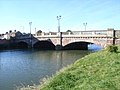 A508 bridge across the river - geograph.org.uk - 1410988.jpg 640 × 480; 83 KB
-
 Agony in the Garden of Gethsemane - geograph.org.uk - 977352.jpg 236 × 636; 55 KB
-
 Agriphila straminella (36282984741).jpg 2,517 × 2,517; 4.41 MB
-
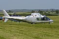 Agusta 109A Mk.II ‘2-LIFT’ (33367336635).jpg 5,439 × 3,626; 13.61 MB
-
 Albatros D.Va replica (ZK-TGY) (20640168676).jpg 5,171 × 3,447; 12.63 MB
-
 Allard L1 dashboard.jpg 4,320 × 3,240; 3.02 MB
-
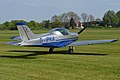 Alpi Aviation Pioneer 300 ‘G-IPKA’ (27502032928).jpg 5,223 × 3,482; 11.23 MB
-
 Ancient moat at Cressy Hall (geograph 4139775).jpg 4,320 × 3,240; 5.77 MB
-
 Aphids - Sandy, Bedfordshire, England.jpg 3,068 × 2,274; 970 KB
-
 Army Scene (8037035302).jpg 3,241 × 2,851; 1.34 MB
-
 Ashwell, St Mary's church, East window (41032943175).jpg 3,027 × 3,787; 5.16 MB
-
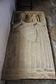
 Ashwell, St Mary's church, Effigy (40125190310).jpg 5,392 × 3,203; 6.75 MB
-
 Ashwell, St Mary's church, Stained glass window (40125192190).jpg 2,464 × 5,376; 6.1 MB
-
 Ashwell, St Mary's church, Stained glass window detail (41991677931).jpg 2,660 × 2,848; 3.03 MB
-
 The Church of St Denys, Aswarby (geograph 2378023).jpg 640 × 480; 82 KB
-
 The Church of St Denys, Aswarby (geograph 2378751).jpg 480 × 640; 74 KB
-
 Auster 5 TW467 (G-ANIE) (6972149636).jpg 3,069 × 2,046; 5.57 MB
-
 Auster AOP.6 ‘TW536’ (32243765873).jpg 5,212 × 3,475; 13.41 MB
-
 Auster J-2 Arrow G-BEAH signwriting detail (7081508641).jpg 2,697 × 1,798; 3.45 MB
-
 Auster J-5G Cirrus Autocar A11-301 931 (G-ARKG) (6970606604).jpg 2,896 × 1,931; 4.67 MB
-
 Avro Nineteen Srs.2 'G-AHKX' (12837066404).jpg 4,264 × 2,843; 8.3 MB
-
 Ayston, St Mary's church, Window detail (41134079435).jpg 3,236 × 3,555; 7.79 MB
-
 Butter Cross, Bainton - geograph.org.uk - 1473299.jpg 640 × 480; 114 KB
-
 Baptism of Jesus - geograph.org.uk - 977356.jpg 427 × 640; 67 KB
-
 Baptème de lady Victoria Cecil le 13 novembre 1844, par B Ziegler.jpg 4,608 × 2,532; 2.09 MB
-
 Barrowden, Rutland - geograph.org.uk - 230808.jpg 640 × 427; 113 KB
-
 Barry Road Boys School, Barry Road - geograph.org.uk - 1411276.jpg 640 × 480; 69 KB
-
 Beckets Park, Northampton - geograph.org.uk - 178657.jpg 640 × 480; 88 KB
-
 Becketts Park Lock - geograph.org.uk - 1410947.jpg 640 × 480; 96 KB
-
 Becketts Park Lock - geograph.org.uk - 1410962.jpg 640 × 480; 106 KB
-
 Bedford (18613273494).jpg 4,000 × 3,000; 3.24 MB
-
 Bedford (19239518381).jpg 4,000 × 3,000; 2.14 MB
-
 Bedford Bridge (1).jpg 4,000 × 2,672; 1.82 MB
-
 Bedford School c.1980 - geograph.org.uk - 256069.jpg 640 × 376; 78 KB
-
-
 Bedford Town v Carshalton (8114514174).jpg 2,048 × 1,536; 2.27 MB
-
 StFrancescaCabriniBedford.JPG 960 × 1,280; 530 KB
-
 Ss Peter & Paul church, Belton, Lincs. (22591448967).jpg 2,197 × 3,834; 3.75 MB
-
 Stained glass window detail, Ss Peter & Paul's church, Belton (22388904663).jpg 2,848 × 4,272; 4.93 MB
-
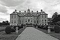 Belton House (33933345134).jpg 4,881 × 3,249; 3.84 MB
.jpg)


.jpg)


.jpg)


.jpg)
.jpg)
.jpg)


.jpg)


.jpg)
.jpg)


.jpg)

.jpg)
.jpg)


.jpg)

.jpg)
.jpg)
.jpg)
.jpg)
.jpg)

.jpg)
.jpg)


.jpg)
.jpg)


.jpg)
.jpg)
.jpg)

.jpg)


.jpg)

.jpg)
.jpg)


_interceding.jpg)


.jpg)
.jpg)

.jpg)
.jpg)


.jpg)


.jpg)


.jpg)


_p2.274_-_Belton_House,_Lincolnshire.jpg)
.jpg)
.jpg)


.jpg)
.jpg)
.jpg)
.jpg)
.jpg)
.jpg)
.jpg)
.jpg)
.jpg)

.jpg)


.jpg)
.jpg)
.jpg)

.jpg)
.jpg)

.jpg)


_(cropped).jpg)
.jpg)


.jpg)
.jpg)
_(20640168676).jpg)

.jpg)
.jpg)

.jpg)
.jpg)
.jpg)
.jpg)
.jpg)
.jpg)
.jpg)
_(6972149636).jpg)
.jpg)
_(6970606604).jpg)
.jpg)
.jpg)


.jpg)
.jpg)
.jpg)


.jpg)

.jpg)
.jpg)
.jpg)
&filefrom=Belton+House+%2834734965066%29.jpg#mw-category-media)
.jpg)