Category:Locator maps of wards in Bristol
Media in category "Locator maps of wards in Bristol"
The following 71 files are in this category, out of 71 total.
-
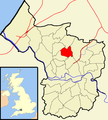
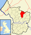
 Ashley Bristol UK ward map.svg 1,138 × 1,266; 709 KB
-
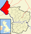
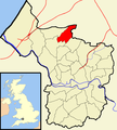
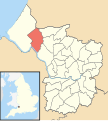
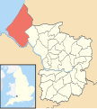 Avonmouth Bristol UK ward map.svg 1,138 × 1,266; 709 KB
-
 Bedminster Bristol UK ward map.svg 1,138 × 1,266; 709 KB
-
 Bishopston Bristol UK ward map.svg 1,138 × 1,266; 709 KB
-
 Bishopsworth Bristol UK ward map.svg 1,138 × 1,266; 709 KB
-
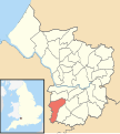
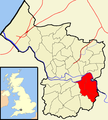
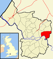
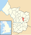
 Brislington East Bristol UK ward map.svg 1,138 × 1,266; 709 KB
-
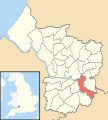 Brislington West Bristol UK ward map.svg 1,138 × 1,266; 709 KB
-
 Bristol ashley.png 702 × 780; 148 KB
-
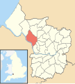
 Bristol avonmouth.png 702 × 780; 144 KB
-
 Bristol bedminster.png 702 × 780; 148 KB
-
 Bristol bishopston.png 702 × 780; 149 KB
-
 Bristol bishopsworth.png 702 × 780; 148 KB
-
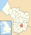
 Bristol brislington.png 702 × 780; 149 KB
-
 Bristol cabot.png 702 × 780; 149 KB
-
 Bristol clifton.png 702 × 780; 149 KB
-
 Bristol cotham.png 702 × 780; 145 KB
-
 Bristol easton.png 702 × 780; 148 KB
-
 Bristol eastville.png 702 × 780; 148 KB
-
 Bristol filwood.png 702 × 780; 145 KB
-
 Bristol frome.png 702 × 780; 148 KB
-
 Bristol hartcliffe.png 702 × 780; 149 KB
-
 Bristol henbury.png 702 × 780; 148 KB
-
 Bristol hengrove.png 702 × 780; 149 KB
-
 Bristol henleaze.png 702 × 780; 145 KB
-
 Bristol hillfields.png 702 × 780; 148 KB
-
 Bristol horfield.png 702 × 780; 148 KB
-
 Bristol knowle.png 702 × 780; 149 KB
-
 Bristol lawrencehill.png 702 × 780; 149 KB
-
 Bristol lockleaze.png 702 × 780; 148 KB
-
 Bristol redland.png 702 × 780; 145 KB
-
 Bristol southmead.png 702 × 780; 148 KB
-
 Bristol southville.png 702 × 780; 148 KB
-
 Bristol stgeorge.png 702 × 780; 148 KB
-
 Bristol stgeorgewest.png 702 × 780; 152 KB
-
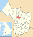
 Bristol stockwood.png 702 × 780; 148 KB
-
 Bristol stokebishop.png 702 × 780; 149 KB
-
 Bristol ward map (1983 to 1999).png 745 × 841; 199 KB
-
 Bristol ward map (1999 to 2016).png 745 × 841; 206 KB
-
 Bristol ward map (2016 onwards).png 745 × 841; 198 KB
-
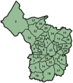
 Bristol wards 1983 to 1999.png 880 × 980; 168 KB
-
 Bristol westbury.png 702 × 780; 145 KB
-
 Bristol whitchurchpark.png 702 × 780; 148 KB
-
 Bristol windmillhill.png 702 × 780; 148 KB
-
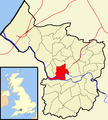
 Cabot Bristol UK ward map.svg 1,138 × 1,266; 709 KB
-
 Clifton Bristol UK ward map.svg 1,138 × 1,266; 709 KB
-
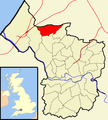
 Clifton East Bristol UK ward map.svg 1,138 × 1,266; 709 KB
-
 Cotham Bristol UK ward map.svg 1,138 × 1,266; 709 KB
-
 Easton Bristol UK ward map.svg 1,138 × 1,266; 709 KB
-
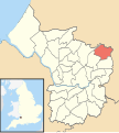
 Eastville Bristol UK ward map.svg 1,138 × 1,266; 709 KB
-
 Filwood Bristol UK ward map.svg 1,138 × 1,266; 709 KB
-
 Frome Vale Bristol UK ward map.svg 1,138 × 1,266; 709 KB
-
 Hartcliffe Bristol UK ward map.svg 1,138 × 1,266; 709 KB
-
 Henbury Bristol UK ward map.svg 1,138 × 1,266; 709 KB
-
 Hengrove Bristol UK ward map.svg 1,138 × 1,266; 709 KB
-
 Henleaze Bristol UK ward map.svg 1,138 × 1,266; 709 KB
-
 Hillfields Bristol UK ward map.svg 1,138 × 1,266; 709 KB
-
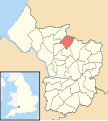 Horfield Bristol UK ward map.svg 1,138 × 1,266; 709 KB
-
 Kingsweston Bristol UK ward map.svg 1,138 × 1,266; 709 KB
-
 Knowle Bristol UK ward map.svg 1,138 × 1,266; 709 KB
-
 Lawrence Hill Bristol UK ward map.svg 1,138 × 1,266; 709 KB
-
 Lockleaze Bristol UK ward map.svg 1,138 × 1,266; 709 KB
-
 Redland Bristol UK ward map.svg 1,138 × 1,266; 709 KB
-
 Southmead Bristol UK ward map.svg 1,138 × 1,266; 709 KB
-
 Southville Bristol UK ward map.svg 1,138 × 1,266; 709 KB
-
 St George East Bristol UK ward map.svg 1,138 × 1,266; 709 KB
-
 St George West Bristol UK ward map.svg 1,138 × 1,266; 709 KB
-
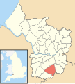
 Stockwood Bristol UK ward map.svg 1,138 × 1,266; 709 KB
-
 Stoke Bishop Bristol UK ward map.svg 1,138 × 1,266; 709 KB
-
 Westbury-on-Trym Bristol UK ward map.svg 1,138 × 1,266; 709 KB
-
 Whitchurch Park Bristol UK ward map.svg 1,138 × 1,266; 709 KB
-
 Windmill Hill Bristol UK ward map.svg 1,138 × 1,266; 709 KB


.png)
.png)
.png)


