File:Taiwan district boundary sign comparison.jpg
Size of this preview: 800 × 450 pixels. Other resolutions: 320 × 180 pixels | 640 × 360 pixels | 1,024 × 576 pixels | 1,280 × 720 pixels | 3,264 × 1,836 pixels.
Original file (3,264 × 1,836 pixels, file size: 2.07 MB, MIME type: image/jpeg)
Captions
Captions
Taiwan district boundary sign comparison
Summary edit
| Description |
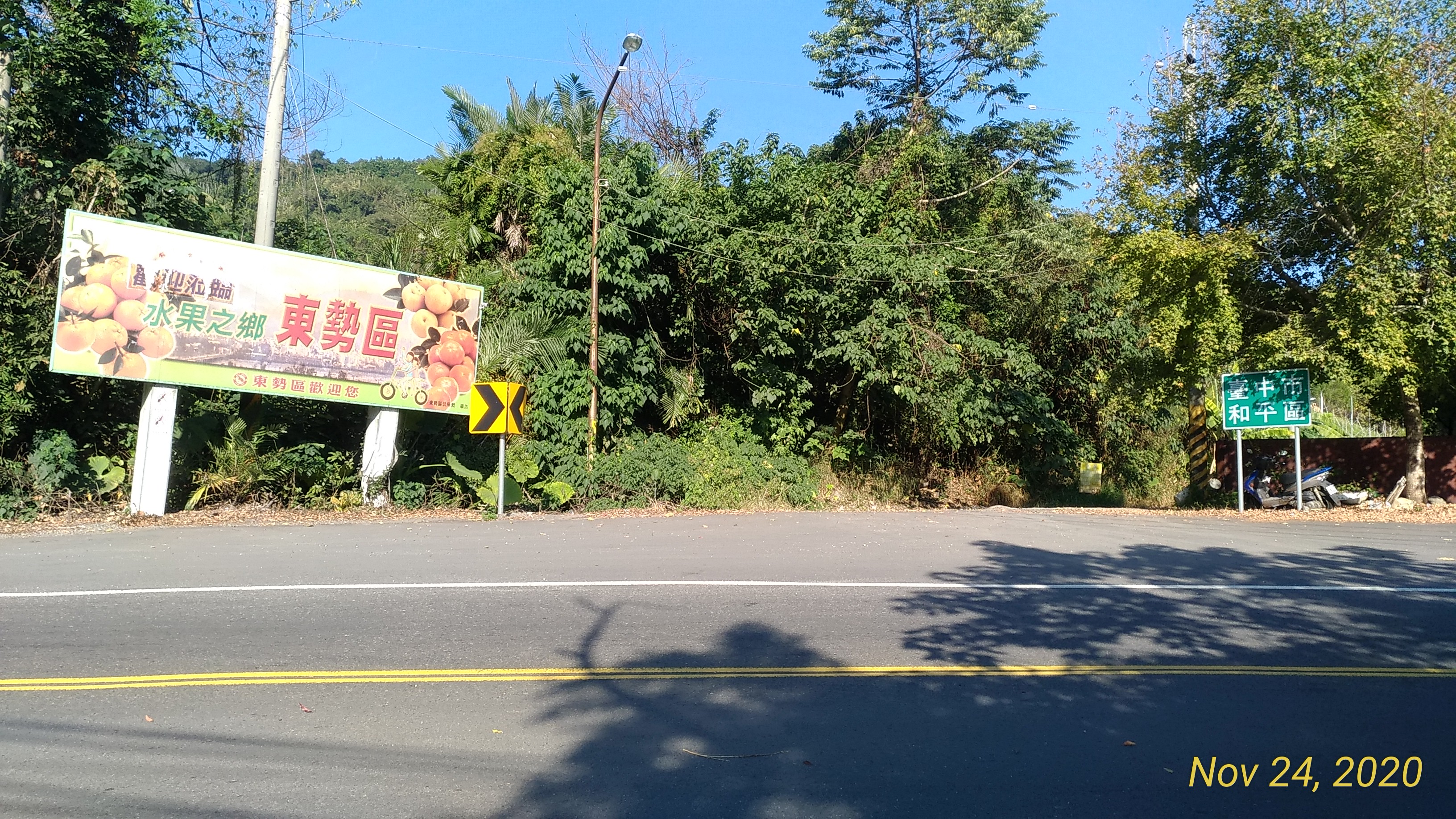
English: Looking north across the Central Cross-Island Highway (Provincial Highway 8) at the boundary between Dongshi (left, larger welcome sign), and Heping (right, simple green sign) Districts, Taichung, Taiwan. (Strictly speaking, we are still 30 meters west of the real boundary.)
中文:區界牌大比一比:站在台8線南側向北拍台中市東勢(左,大歡迎牌),及和平(右,小綠牌)區界。(嚴格來講,離真界以西 30 公尺。) |
| Date | 24 November 2020 (according to Exif data) |
| Source | Own work |
| Author | Jidanni |
| Camera location | | View this and other nearby images on: OpenStreetMap |
|---|
Licensing edit
I, the copyright holder of this work, hereby publish it under the following license:
This file is licensed under the Creative Commons Attribution-Share Alike 4.0 International license.
- You are free:
- to share – to copy, distribute and transmit the work
- to remix – to adapt the work
- Under the following conditions:
- attribution – You must give appropriate credit, provide a link to the license, and indicate if changes were made. You may do so in any reasonable manner, but not in any way that suggests the licensor endorses you or your use.
- share alike – If you remix, transform, or build upon the material, you must distribute your contributions under the same or compatible license as the original.
| This file was uploaded via Mobile Android App (Commons mobile app) 2.13.1.835~9375a8b. |
File history
Click on a date/time to view the file as it appeared at that time.
| Date/Time | Thumbnail | Dimensions | User | Comment | |
|---|---|---|---|---|---|
| current | 02:02, 25 November 2020 | | 3,264 × 1,836 (2.07 MB) | Jidanni (talk | contribs) | Uploaded using Commons Mobile App |
You cannot overwrite this file.
File usage on Commons
The following page uses this file: