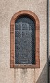
Category:Église Saint-Étienne (Remich)
| Object location | | View all coordinates using: OpenStreetMap |
|---|
 .jpg) | |||||
| Upload media | |||||
| Instance of | |||||
|---|---|---|---|---|---|
| Location |
| ||||
 | |||||
Subcategories
This category has only the following subcategory.
Media in category "Église Saint-Étienne (Remich)"
The following 11 files are in this category, out of 11 total.
-
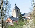 Eglise remich.jpg 1,536 × 1,242; 236 KB
-
 Kirche Remich 02.jpg 1,890 × 1,478; 1.5 MB
-
 Kirche Remich 03.jpg 1,346 × 2,075; 1.86 MB
-
 Saint Stephen church in Remich (1).jpg 5,607 × 5,117; 16.25 MB
-
 Saint Stephen church in Remich (14).jpg 5,910 × 5,574; 21.59 MB
-
 Saint Stephen church in Remich (15).jpg 2,819 × 5,291; 10.93 MB
-
 Saint Stephen church in Remich (16).jpg 3,529 × 5,753; 17.04 MB
-
 Saint Stephen church in Remich (17).jpg 5,025 × 4,346; 18.72 MB
-
 Saint Stephen church in Remich (18).jpg 3,005 × 5,468; 15.24 MB
-
 Saint Stephen church in Remich (19).jpg 4,191 × 3,008; 9.73 MB
-
 Saint Stephen church in Remich (20).jpg 3,248 × 4,117; 8.26 MB


.jpg)
.jpg)
.jpg)
.jpg)
.jpg)
.jpg)
.jpg)
.jpg)