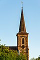
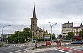
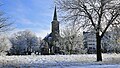
Category:Église Saints-Pierre-et-Paul (Hollerich)
| Object location | | View all coordinates using: OpenStreetMap |
|---|
 | |||||
| Upload media | |||||
| Instance of | |||||
|---|---|---|---|---|---|
| Location |
| ||||
 | |||||
Media in category "Église Saints-Pierre-et-Paul (Hollerich)"
The following 12 files are in this category, out of 12 total.
-
 Hollerecher Kierch-101.jpg 2,934 × 4,396; 11.96 MB
-
 Hollerecher Kierch-102.jpg 4,088 × 6,125; 16.47 MB
-
 Iglesia ortodoxa serbia, ciudad de Luxemburgo, Luxemburgo, 2023-12-17, DD 76.jpg 4,300 × 8,422; 10.47 MB
-
 Kirche Hollerich 01.jpg 1,850 × 2,757; 3.41 MB
-
 Kirche Hollerich 02.jpg 2,469 × 2,070; 4.43 MB
-
 Kirche Hollerich 03.jpg 2,821 × 1,800; 3.8 MB
-
 Kirche Hollerich 04.jpg 2,655 × 1,910; 3.54 MB
-
 Luxembourg, Hollerich, autour de l'église (101).jpg 3,285 × 1,848; 2.2 MB
-
 Lëtzebuerg-Hollerech Kierch.jpg 582 × 1,024; 98 KB
-
 Preĝejo Saints-Pierre-et-Paul (Hollerich) en Luksemburgo 01.jpg 2,336 × 4,160; 3.96 MB
-
 Preĝejo Saints-Pierre-et-Paul (Hollerich) en Luksemburgo 02.jpg 2,336 × 4,160; 4.39 MB
-
 Preĝejo Saints-Pierre-et-Paul (Hollerich) en Luksemburgo 03.jpg 2,336 × 4,160; 4.71 MB


.jpg)

_en_Luksemburgo_01.jpg)
_en_Luksemburgo_02.jpg)
_en_Luksemburgo_03.jpg)