Category:Émetteur de Sottens
| Object location | | View all coordinates using: OpenStreetMap |
|---|
broadcasting tower in Sottens in the canton of Vaud, Switzerland | |||||
| Upload media | |||||
| Instance of | |||||
|---|---|---|---|---|---|
| Part of | |||||
| Location |
| ||||
| Street address |
| ||||
| Owned by |
| ||||
| Heritage designation | |||||
| Inception |
| ||||
 | |||||
Media in category "Émetteur de Sottens"
The following 14 files are in this category, out of 14 total.
-
 Antenne de Sottens.jpg 3,421 × 5,132; 12.92 MB
-
 Emetteur de Sottens au crépuscule.jpg 1,296 × 968; 257 KB
-
 Emetteur de Sottens Vaud Suisse.jpg 968 × 1,296; 191 KB
-
 Emetteur de Sottens.jpeg 1,256 × 1,561; 508 KB
-
 KGS-Nr. 10354.JPG 4,896 × 3,672; 3.62 MB
-
 Luftaufnahme Landessender Sottens VD.tif 2,026 × 1,301; 8.18 MB
-
 Museum für Kommunikation Bern FFF 00422 Radiosender Sottens Innenaufnahme.tif 4,169 × 3,225; 12.84 MB
-
 Museum für Kommunikation Bern FFF 11578 Radiosender Sottens.tif 2,870 × 3,807; 31.28 MB
-
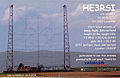 QSL HE3RSI.jpg 1,200 × 781; 295 KB
-
 Sottens 1.jpg 5,202 × 3,465; 12.38 MB
-
 Sottens 2.jpg 5,202 × 3,465; 12.49 MB
-
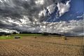 Sottens 3.jpg 5,202 × 3,465; 12.44 MB
-
 Sottens 4.jpg 5,202 × 3,465; 12.69 MB
-
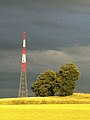
 Transmitter Sottens 765khz 1.jpg 510 × 768; 54 KB


