Category:1600s maps
| 17th-century maps: ← 1600s 1610s 1620s 1630s 1640s 1650s 1660s 1670s 1680s 1690s → |
Not to be confused with maps depicting the 1600s.
Subcategories
This category has the following 20 subcategories, out of 20 total.
Media in category "1600s maps"
The following 9 files are in this category, out of 9 total.
-
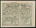 Barbaria (FL13721000 2370178).jpg 3,488 × 2,792; 14.4 MB
-
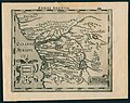
 Bertius map of Tartaria.jpg 3,351 × 2,509; 1.37 MB
-
 Bretten und Umgebung 1606.jpg 3,774 × 3,736; 4.4 MB
-
 Congi Regnum (FL13720976 2370176).jpg 3,526 × 2,784; 13.1 MB
-

-
 Mellinger1593fuerstentumlueneburg.jpg 2,428 × 1,810; 7.23 MB
-
 Pictorial Map of the Tōkaidō Highroad WDL9933.jpg 5,611 × 1,024; 885 KB
-
 Steenwiick (FL167448853 2370140).jpg 13,389 × 11,352; 181.42 MB
-
 Virginiae item et Floridae Americae provinciarum, nova descriptio. NYPL434008.tiff 3,831 × 3,200; 35.11 MB
.jpg)


.jpg)
_-_btv1b8596101d.jpg)

.jpg)