Category:16th-century maps of North America
Temperate regions: North America · South America · Africa · Europe · Asia · Oceania – Polar regions: Antarctica · Arctic – Other regions:
Subcategories
This category has the following 17 subcategories, out of 17 total.
Media in category "16th-century maps of North America"
The following 7 files are in this category, out of 7 total.
-
 1562-Diego Gutiérrez.jpg 1,302 × 989; 560 KB
-

-
 Atlasofportolanc00magg orig 0026.tif 2,868 × 3,681; 40.28 MB
-
 Disegno del discoperto della Nova Franza (1565).png 2,000 × 1,410; 4.84 MB
-
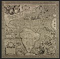 Gutiérrez, the Americas, 1562.jpg 5,246 × 5,148; 16.62 MB
-
 Iroquoiens St Laurent.png 336 × 282; 26 KB
-
 Mesoamérica y Centroamerica prehispanica siglo XVI.jpg 20,001 × 13,538; 21.4 MB

.jpg)
.png)


