Category:1700s maps of Denmark
Countries of Europe: Albania · Armenia‡ · Austria · Azerbaijan‡ · Belgium · Croatia · Denmark · France‡ · Georgia‡ · Germany · Greece · Hungary · Republic of Ireland · Italy · Lithuania · Netherlands‡ · Norway · Portugal‡ · Romania · Russia‡ · Serbia · Slovenia · Spain‡ · Sweden · Switzerland · Turkey‡ · Ukraine
‡: partly located in Europe
‡: partly located in Europe
Subcategories
This category has the following 2 subcategories, out of 2 total.
S
Media in category "1700s maps of Denmark"
The following 3 files are in this category, out of 3 total.
-
 A chart of JUTLAND and the Islands of Omtren (NYPL b13909432-1640696).jpg 5,780 × 4,770; 6.98 MB
-
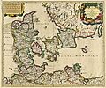 1705 Danemark Valck 155.JPG 5,255 × 4,390; 19.96 MB
-
 Store Dyrehave c. 1700.jpg 450 × 500; 154 KB
.jpg)

