Category:1700s maps of Japan
Countries of Asia: Armenia‡ · Azerbaijan‡ · People's Republic of China · Egypt‡ · Georgia‡ · India · Indonesia‡ · Iran · Iraq · Japan · Philippines · Russia‡ · Syria · Turkey‡
Limited recognition: Taiwan · State of Palestine
‡: partly located in Asia
Limited recognition: Taiwan · State of Palestine
‡: partly located in Asia
Subcategories
This category has the following 2 subcategories, out of 2 total.
Media in category "1700s maps of Japan"
The following 7 files are in this category, out of 7 total.
-

-

-
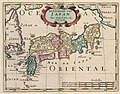 AMH-6666-KB Map of Japan.jpg 2,400 × 1,872; 907 KB
-
 Funai ryakuzu (14151946813).jpg 1,851 × 2,000; 1.81 MB
-
 Kaisei dai Nihon bizu (carte du Japon) - par Jikôan Mabuchi - btv1b53066779q.jpg 10,633 × 16,045; 20.2 MB
-
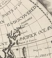 Companies Land.jpeg 770 × 873; 732 KB
-
 Revised and fully-equipped map of Japan (14327518791).jpg 2,500 × 1,608; 1.31 MB


.jpg)
_-_par_Jik%C3%B4an_Mabuchi_-_btv1b53066779q.jpg)

.jpg)