Category:1702 maps of France
Media in category "1702 maps of France"
The following 6 files are in this category, out of 6 total.
-

-
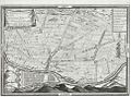 Lyon. La Guillotière. Plan. 1702.JPG 961 × 715; 204 KB
-

-
 The sea-coasts of FRANCE from Calais to the River Seine (NYPL b13909432-1640585).jpg 6,292 × 4,977; 6.43 MB
-

-
 The River of BOURDEAUX and Bay of ARCASSON (NYPL b13909432-1640600).jpg 6,280 × 4,915; 6.19 MB


.jpg)
.jpg)
.jpg)