Category:1720s maps of Ukraine
Countries of Europe: Albania · Armenia‡ · Azerbaijan‡ · Belgium · Bosnia and Herzegovina · Bulgaria · Croatia · Cyprus‡ · Denmark · France‡ · Georgia‡ · Germany · Greece · Hungary · Republic of Ireland · Italy · Lithuania · Montenegro · Netherlands‡ · Norway · Poland · Portugal‡ · Romania · Russia‡ · Serbia · Slovenia · Spain‡ · Sweden · Switzerland · Turkey‡ · Ukraine · United Kingdom
Limited recognition: Abkhazia‡
‡: partly located in Europe
Limited recognition: Abkhazia‡
‡: partly located in Europe
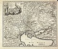
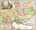
Media in category "1720s maps of Ukraine"
The following 5 files are in this category, out of 5 total.
-
 Map HOMANNO Ukrania.jpg 3,000 × 2,521; 2.44 MB
-
-

-

-
 Matthäus Seutter - Nova et acrurata Tartariae Europae seu minoris.jpg 640 × 512; 130 KB

.jpg)


