Category:1720s maps of the Russian Empire
Great Britain · Habsburg Monarchy · Holy Roman Empire · Ottoman Empire · Tsardom of Russia · Russian Empire ·
Subcategories
This category has the following 5 subcategories, out of 5 total.
- 1728 maps of the Russian Empire (empty)
'
Media in category "1720s maps of the Russian Empire"
The following 10 files are in this category, out of 10 total.
-

-
 Фрагмент карты Лужина 1722 года.png 4,383 × 5,281; 25.1 MB
-
 Карта Евреинова и Лужина.png 1,536 × 960; 762 KB
-
 Delisle - Carte d'Asie (Compagnieland).jpg 783 × 799; 576 KB
-
 Joachim Ottens. Nova ac Verissima Maris Caspii. 1723.jpg 1,690 × 1,390; 2.74 MB
-

-
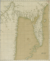
 1728 map of the Western Caspian Sea region by Joseph Nicholas de L'Isle.jpg 9,939 × 12,584; 22.24 MB
-
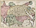 La Russie Asiatique tirée de la Carte Donnée par Ordre du Feu Czar.jpg 4,319 × 3,384; 5.03 MB
-
 Uktus plant.jpg 1,612 × 1,128; 1.27 MB
-
 Уктусский завод.jpg 3,017 × 1,925; 1.46 MB


.jpg)

.jpg)


