Category:1747 Persia map by Emanuel Bowen
Media in category "1747 Persia map by Emanuel Bowen"
The following 22 files are in this category, out of 22 total.
-
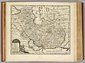
 Bowen, Emanuel. Persia, adjacent countries. 1747 (A).jpg 4,038 × 3,338; 3.45 MB
-
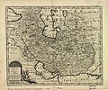
 Bowen, Emanuel. Persia, adjacent countries. 1747.jpg 5,789 × 4,273; 4.66 MB
-
 New and accurate map of Persia.jpg 5,664 × 4,715; 7.23 MB
-
 Persian(IRAN) Empire 1747.jpg 5,420 × 4,548; 8.38 MB
-

-

-
 Aras River in Persian (IRAN) Empire 1747 map.JPG 1,223 × 445; 77 KB
-
 Bowen, Emanuel. Persia, adjacent countries. 1747 (B).jpg 1,865 × 1,279; 658 KB
-
 Bowen, Emanuel. Persia, adjacent countries. 1747 (BA).jpg 1,120 × 756; 292 KB
-
 Bowen, Emanuel. Persia, adjacent countries. 1747 (BB).jpg 761 × 691; 191 KB
-
 Bowen, Emanuel. Persia, adjacent countries. 1747 (BC).jpg 986 × 870; 281 KB
-
 Bowen, Emanuel. Persia, adjacent countries. 1747 (C).jpg 1,608 × 1,402; 724 KB
-
 Bowen, Emanuel. Persia, adjacent countries. 1747 (D).jpg 1,899 × 2,948; 1.47 MB
-
 Bowen, Emanuel. Persia, adjacent countries. 1747 (DA).jpg 1,899 × 1,258; 576 KB
-
 Bowen, Emanuel. Persia, adjacent countries. 1747 (DB).jpg 1,899 × 1,184; 725 KB
-
 Bowen, Emanuel. Persia, adjacent countries. 1747 (DC).jpg 1,899 × 1,055; 609 KB
-
 Bowen, Emanuel. Persia, adjacent countries. 1747 (E).jpg 1,067 × 985; 301 KB
-
 Caspian sea in Persian (IRAN) Empire 1747.JPG 512 × 729; 84 KB
-
 Map of Afghanistan during the Safavid and Moghul Empire.jpg 2,532 × 1,736; 1.16 MB
-
 Persian(IRAN) Empire 1747 (A).JPG 1,513 × 874; 242 KB
-
 Persian(IRAN) Empire 1747 (B).JPG 1,173 × 616; 144 KB
-
 گیلان در نقشه امپراطوری افشاریه سال 1747 میادی.jpg 817 × 753; 118 KB
.jpg)


_Empire_1747.jpg)

.jpg)
.jpg)
.jpg)
.jpg)
.jpg)
.jpg)
.jpg)
.jpg)
.jpg)
.jpg)
_Empire_1747.JPG)

_Empire_1747_(A).JPG)
_Empire_1747_(B).JPG)

_Empire_1747_map.JPG)