Category:1750s maps of Iran
Countries of Asia: People's Republic of China · Egypt‡ · Georgia‡ · India · Indonesia‡ · Iran · Japan · Lebanon · Philippines · Russia‡ · Syria · Turkey‡
Limited recognition: Taiwan · State of Palestine
‡: partly located in Asia
Limited recognition: Taiwan · State of Palestine
‡: partly located in Asia
Media in category "1750s maps of Iran"
The following 8 files are in this category, out of 8 total.
-
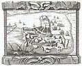 1750 Schley Map of Ormus, Persian Gulf - Geographicus - Ormus-schley-1750.jpg 2,500 × 2,015; 1.78 MB
-

-

-

-

-
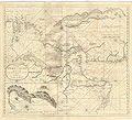 Afteekening van de Persische Golf.JPG 3,543 × 3,217; 11.76 MB
-
 AMH-2532-NA Map of the Persian Gulf.jpg 2,400 × 2,146; 1.28 MB
-


,_1766_persia_1752_north_west.jpg)
,_1766_persia_1752_south_east.jpg)
,_1766_persia_1752_south_west.jpg)
,_1766_persia_1752.jpg)


.jpg)