Category:1760s maps of the Atlantic Ocean
Subcategories
This category has the following 2 subcategories, out of 2 total.
Media in category "1760s maps of the Atlantic Ocean"
The following 9 files are in this category, out of 9 total.
-
 AMH-8035-KB Map of the Atlantic and Indian Oceans.jpg 2,400 × 1,519; 891 KB
-
-
-

-

-

-
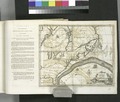
 Franklin-Folger chart of the Gulf Stream - btv1b7200342r (1 of 4).jpg 5,494 × 4,812; 4.61 MB
-
 Franklin-Folger chart of the Gulf Stream - btv1b7200342r (4 of 4).jpg 7,216 × 5,401; 5.71 MB
-


_-..._-_btv1b10678537h.jpg)

.jpg)
.jpg)