Category:1780 maps of France
Countries of Europe: France‡ · Georgia‡ · Germany · Greece · Italy · Norway · Spain‡ · Sweden · Turkey‡
‡: partly located in Europe
‡: partly located in Europe
Subcategories
This category has the following 5 subcategories, out of 5 total.
Media in category "1780 maps of France"
The following 6 files are in this category, out of 6 total.
-
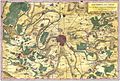 1780 Bonne Map of the Environs of Paris, France - Geographicus - Paris-bonne-1780 (2).jpg 3,783 × 2,567; 5.93 MB
-
 1780 Bonne Map of the Environs of Paris, France - Geographicus - Paris-bonne-1780.jpg 4,000 × 2,762; 2.09 MB
-
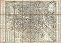 1780 Esnauts and Rapilly Case Map of Paris - Geographicus - Paris-esnautsrapilly-1780.jpg 4,986 × 3,514; 12.57 MB
-
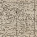
 1780 Raynal and Bonne Map of France - Geographicus - France-bonne-1780.jpg 2,500 × 1,686; 1.27 MB
-
 Détail Paris et région de la carte de France de Mathias Robert de Hesseln de 1780.jpg 1,052 × 1,040; 391 KB
-
 Louis-Charles Desnos, Plan de Paris divisé en six tribunaux, ca 1780 - BHVP.jpg 2,252 × 2,395; 1.18 MB
.jpg)


