Category:1786 maps of South America
Temperate regions: North America · South America · Africa · Europe · Asia · – Polar regions: – Other regions:
| ← 1780 1781 1782 1783 1784 1785 1786 1787 1788 1789 → |
Media in category "1786 maps of South America"
The following 19 files are in this category, out of 19 total.
-

-

-
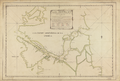 Map of the Straits of Magellan and Part of the Land of Fire, Prepared in 1786 WDL52.png 1,511 × 1,024; 2.25 MB
-

-

-

-

-

-

-

-
-

-

-

-

-

-

-

-
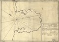
 Plano Trujillo 1786.jpg 1,024 × 725; 749 KB


_20%CA%BA_occidental_de_C%C3%A1diz_LOC_91680522.jpg)


_de_66_gros_occidental_de_C%C3%A1diz_LOC_91680521.jpg)


