Category:1790s maps of Latvia
Countries of Europe: Albania · Armenia‡ · Austria · Belarus · Belgium · Bosnia and Herzegovina · Bulgaria · Croatia · Cyprus‡ · Denmark · Estonia · France‡ · Georgia‡ · Germany · Greece · Hungary · Republic of Ireland · Italy · Latvia · Lithuania · Moldova · Netherlands‡ · Norway · Poland · Portugal‡ · Romania · Russia‡ · Serbia · Slovakia · Slovenia · Spain‡ · Sweden · Switzerland · Turkey‡ · Ukraine · United Kingdom
Limited recognition: Abkhazia‡
‡: partly located in Europe
Limited recognition: Abkhazia‡
‡: partly located in Europe
Media in category "1790s maps of Latvia"
The following 5 files are in this category, out of 5 total.
-
 BalticCorp.jpg 781 × 565; 129 KB
-
 Karte von Polen und den angränzenden Provinzen 02.jpg 5,582 × 4,572; 6.65 MB
-
 Map of Courland Governorate 1796 (small atlas).jpg 2,882 × 2,421; 934 KB
-
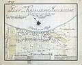 Jēkabpils plāns 1797.jpg 1,013 × 803; 867 KB
-
 Rūjienas draudzes novads (1798).jpg 2,737 × 2,649; 4.07 MB


.jpg)

.jpg)