Category:1790s maps of the Philippines
- Provinces of the Philippines
- Province-level divisions (independent cities, Metro Manila)
Media in category "1790s maps of the Philippines"
The following 8 files are in this category, out of 8 total.
-

-
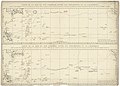
 NL-HaNA 4.MIKO 552V-groot.jpg 10,000 × 6,909; 5.05 MB
-

-
-

-
 Plan de la baye de Manille - btv1b5963247b.jpg 3,296 × 2,752; 1.46 MB
-

-
 Salaverria 1797 Map of Panay Island.jpg 2,854 × 3,682; 2.29 MB


