Category:17 Kopernika Street in Kraków (Hospital)
| Object location | | View all coordinates using: OpenStreetMap |
|---|
hospital .jpg) | |||||
| Upload media | |||||
| Instance of | |||||
|---|---|---|---|---|---|
| Location | Kraków, Lesser Poland Voivodeship, Poland | ||||
| Street address |
| ||||
| Heritage designation |
| ||||
| Inception |
| ||||
 | |||||
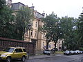
Polski: Szpital Uniwersytecki w Krakowie. Budynek kliniczny oddany w 1879.
| Address |
|
Media in category "17 Kopernika Street in Kraków (Hospital)"
The following 8 files are in this category, out of 8 total.
-
 17 Kopernika Street in Kraków bk1.JPG 2,048 × 1,536; 1.69 MB
-
 Kraków, Kopernika 17 (1).jpg 4,752 × 3,168; 5.67 MB
-
 Kraków, Kopernika 17 (2).jpg 4,752 × 3,168; 4.84 MB
-
 Kraków, Kopernika 17 (3).jpg 4,671 × 2,617; 4.12 MB
-
 Kraków, Kopernika 17 (4).jpg 4,752 × 3,168; 6.11 MB
-
 Kraków, Kopernika 17 (5).jpg 4,505 × 3,023; 5.2 MB
-
 Kraków, Kopernika 17.jpg 4,639 × 2,992; 5.82 MB
-
 Szpital św.Łazarza.JPG 1,200 × 1,600; 516 KB

.jpg)
.jpg)
.jpg)
.jpg)

