Category:17th-century maps of Czechia
Countries of Europe: Albania · Armenia‡ · Austria · Azerbaijan‡ · Belarus · Belgium · Bosnia and Herzegovina · Bulgaria · Croatia · Cyprus‡ · Czech Republic · Denmark · Estonia · Finland · France‡ · Georgia‡ · Germany · Greece · Hungary · Iceland · Republic of Ireland · Italy · Latvia · Lithuania · Luxembourg · Malta · Montenegro · Netherlands‡ · Norway · Poland · Portugal‡ · Romania · Russia‡ · Serbia · Slovakia · Slovenia · Spain‡ · Sweden · Switzerland · Turkey‡ · Ukraine · United Kingdom
Specific status: Isle of Man – Limited recognition: Abkhazia‡
‡: partly located in Europe
Specific status: Isle of Man – Limited recognition: Abkhazia‡
‡: partly located in Europe
Subcategories
This category has the following 3 subcategories, out of 3 total.
Media in category "17th-century maps of Czechia"
The following 11 files are in this category, out of 11 total.
-
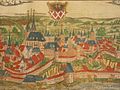 Cheb Bohemia (Czech Republic) (1600) a closer view.jpg 800 × 600; 144 KB
-
 Map of Bohemia (Czech Republic) (1600) northeast.jpg 800 × 600; 149 KB
-
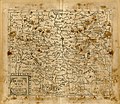
 Map of Bohemia (Czech Republic) (1600) northwest.jpg 800 × 600; 158 KB
-
 Map of Bohemia (Czech Republic) (1600) southeast.jpg 800 × 600; 140 KB
-
 Map of Bohemia (Czech Republic) (1600) southwest.jpg 800 × 600; 155 KB
-
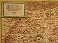
 Map of Bohemia (Czech Republic) (1600).jpg 800 × 600; 123 KB
-

-
 Print, book-illustration, map (BM 1870,1112.112-240).jpg 2,500 × 1,852; 1.27 MB
-
 Print, book-illustration, map (BM 1874,0613.2441-2532).jpg 2,500 × 2,177; 1.49 MB
-
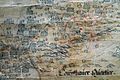 Stich2.JPG 1,600 × 1,068; 640 KB
-
 Stichovamapa.jpg 409 × 293; 37 KB
_(1600)_a_closer_view.jpg)
_(1600)_northeast.jpg)
_(1600)_northwest.jpg)
_(1600)_southeast.jpg)
_(1600)_southwest.jpg)
_(1600).jpg)

.jpg)
.jpg)

