Category:17th-century maps of Mozambique
Countries of Africa: Algeria · Angola · Benin · Cape Verde · Democratic Republic of the Congo · Djibouti · Egypt‡ · Equatorial Guinea · Ethiopia · The Gambia · Ghana · Guinea · Ivory Coast · Kenya · Libya · Madagascar · Morocco · Mozambique · Namibia · Senegal · Somalia · South Africa · Sudan · Tanzania · Tunisia
Other areas: Madeira
‡: partly located in Africa
Other areas: Madeira
‡: partly located in Africa
Media in category "17th-century maps of Mozambique"
The following 8 files are in this category, out of 8 total.
-
 AMH-6147-NA View of Cefala.jpg 2,400 × 1,785; 554 KB
-

-
 Congo map 1690.jpg 1,102 × 867; 1.54 MB
-
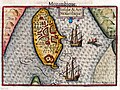 Keere, Pieter van den – Insulae et ars Mozambique, XVII secolo – BEIC IE8964057.jpg 2,592 × 1,936; 1.98 MB
-
 Quadreria di Palazzo Rossi Poggi Marsili - GEP 2023 abc4.jpg 3,363 × 2,727; 5.45 MB
-
 Sofala (1666).jpg 1,193 × 808; 259 KB
-
 Sofala1683.jpg 456 × 701; 97 KB
-
 Sofala1685.jpg 616 × 900; 418 KB

_-_btv1b531432316.jpg)


.jpg)

