Category:17th-century maps of New Zealand
Subcategories
This category has the following 4 subcategories, out of 4 total.
.
- 1650s maps of New Zealand (1 F)
- 1660s maps of New Zealand (1 F)
- 1670s maps of New Zealand (2 F)
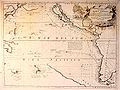
Media in category "17th-century maps of New Zealand"
The following 3 files are in this category, out of 3 total.
-
 AMH-8631-NA Map of the Pacific Ocean.jpg 2,400 × 2,223; 551 KB
-
 Vincenzo Coronelli00.jpg 902 × 678; 194 KB
-
 Gilsemans 1642.jpg 2,960 × 1,924; 1.22 MB


