Category:1800 maps of Washington, D.C.
Media in category "1800 maps of Washington, D.C."
The following 55 files are in this category, out of 55 total.
-
-

-
 (Map of part of central Washington D.C. to the east of the White House). LOC 88694107.jpg 9,192 × 6,701; 5.64 MB
-
 (Map of part of central Washington D.C. to the east of the White House). LOC 88694107.tif 9,192 × 6,701; 176.23 MB
-

-

-
 (Map of the Capitol grounds and surrounding squares, Washington D.C.). LOC 88690761.jpg 6,941 × 5,369; 3.17 MB
-
 (Map of the Capitol grounds and surrounding squares, Washington D.C.). LOC 88690761.tif 6,941 × 5,369; 106.62 MB
-
 (Map of the southern part of the city of Washington D.C.). LOC 88694106.jpg 3,922 × 3,106; 1.41 MB
-
 (Map of the southern part of the city of Washington D.C.). LOC 88694106.tif 3,922 × 3,106; 34.85 MB
-
 (Plan of the White House grounds, Washington D.C.). LOC 88693235.jpg 3,463 × 5,326; 1.71 MB
-
 (Plan of the White House grounds, Washington D.C.). LOC 88693235.tif 3,463 × 5,326; 52.77 MB
-
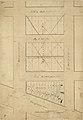
 Cadastral map of part of the West End, Washington D.C.. LOC 88694109.jpg 2,460 × 2,228; 592 KB
-
 Cadastral map of part of the West End, Washington D.C.. LOC 88694109.tif 2,460 × 2,228; 15.68 MB
-

-

-

-

-
 Map of B Street Sewer and associated ponds, Washington D.C.. LOC 87695534.jpg 5,735 × 2,128; 1.3 MB
-
 Map of B Street Sewer and associated ponds, Washington D.C.. LOC 87695534.tif 5,735 × 2,128; 34.92 MB
-

-

-
 Map of the White House grounds, Washington D.C.. LOC 88693236.jpg 3,956 × 6,454; 2.18 MB
-
 Map of the White House grounds, Washington D.C.. LOC 88693236.tif 3,956 × 6,454; 73.05 MB
-

-

-
 Part of new canal - (Washington Canal, Washington D.C.). LOC 88690730.jpg 5,659 × 7,733; 4.2 MB
-
 Part of new canal - (Washington Canal, Washington D.C.). LOC 88690730.tif 5,659 × 7,733; 125.2 MB
-
 Plan of a circle within the Capitol grounds, Washington D.C.. LOC 88690763.jpg 4,816 × 3,928; 1.79 MB
-
 Plan of a circle within the Capitol grounds, Washington D.C.. LOC 88690763.tif 4,816 × 3,928; 54.12 MB
-
 Plan of Hamburg, later part of Washington D.C.. LOC 88690864.jpg 6,212 × 3,945; 2.62 MB
-
 Plan of Hamburg, later part of Washington D.C.. LOC 88690864.tif 6,212 × 3,945; 70.11 MB
-

-

-

-
 Plan of the city of Washington LOC 88694102.jpg 2,299 × 1,925; 803 KB
-
 Plan of the city of Washington LOC 88694102.tif 2,299 × 1,925; 12.66 MB
-

-

-

-

-
 Square no. 118 - (Washington D.C.). LOC 88693120.jpg 3,835 × 3,408; 1.35 MB
-
 Square no. 118 - (Washington D.C.). LOC 88693120.tif 3,835 × 3,408; 37.39 MB
-
 Square no. 275 - (Washington D.C.) LOC 88693122.jpg 4,482 × 5,908; 2.43 MB
-
 Square no. 275 - (Washington D.C.) LOC 88693122.tif 4,482 × 5,908; 75.76 MB
-
 Survey map of Friendship tract, Washington D.C.. LOC 88690853.jpg 3,895 × 3,546; 1.25 MB
-
 Survey map of Friendship tract, Washington D.C.. LOC 88690853.tif 3,895 × 3,546; 39.52 MB
-
 Survey map of part of the Capitol grounds, Washington D.C.. LOC 88690762.jpg 6,159 × 4,933; 3.26 MB
-
 Survey map of part of the Capitol grounds, Washington D.C.. LOC 88690762.tif 6,159 × 4,933; 86.92 MB
-
 Survey map of the White House grounds, Washington D.C.. LOC 88693231.jpg 6,211 × 5,166; 2.66 MB
-
 Survey map of the White House grounds, Washington D.C.. LOC 88693231.tif 6,211 × 5,166; 91.8 MB
-
 Survey of an unidentified area in Washington D.C.. LOC 87694288.jpg 6,779 × 5,124; 3.71 MB
-
 Survey of an unidentified area in Washington D.C.. LOC 87694288.tif 6,779 × 5,124; 99.38 MB
-
 Washington in 1800. LOC 88694103.jpg 3,105 × 2,492; 1.15 MB
-
 Washington in 1800. LOC 88694103.tif 3,105 × 2,492; 22.14 MB
._LOC_88693040.jpg)
._LOC_88694107.jpg)
._LOC_88690780.jpg)
._LOC_88690761.jpg)
._LOC_88694106.jpg)
._LOC_88693235.jpg)

._LOC_88693295.jpg)


._LOC_88693175.jpg)
._LOC_88690730.jpg)


_-_(West_End,_N.W._Washington_D.C.)._LOC_88694104.jpg)

._LOC_88694105.jpg)

._LOC_88693120.jpg)
_LOC_88693122.jpg)


