Category:1802 maps
| ← · 1800 · 1801 · 1802 · 1803 · 1804 · 1805 · 1806 · 1807 · 1808 · 1809 · → |
Deutsch: Karten mit Bezug zum Jahr 1802
English: Maps related to the year 1802
Español: Mapas relativos al año 1802
Français : Cartes concernant l’an 1802
Русский: Карты 1802 года
Subcategories
This category has the following 5 subcategories, out of 5 total.
Media in category "1802 maps"
The following 86 files are in this category, out of 86 total.
-

-

-
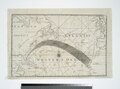 A Chart of the Atlantic or Western Ocean - Jones, sc. NYPL433947.tiff 5,648 × 4,208; 68 MB
-
 A Chart of the Atlantic or Western Ocean. NYPL465943.tiff 5,339 × 4,725; 72.18 MB
-

-
 A sketch of the roads within fourteen miles of Tunbridge Wells. LOC 2018588064.jpg 5,218 × 5,393; 4.46 MB
-
 A sketch of the roads within fourteen miles of Tunbridge Wells. LOC 2018588064.tif 5,218 × 5,393; 80.51 MB
-
 Ages du Volcan de Bourbon. LOC 2004628875.jpg 2,877 × 4,511; 1.37 MB
-
 Ages du Volcan de Bourbon. LOC 2004628875.tif 2,877 × 4,511; 37.13 MB
-

-
 Apra Harbor, 1802 by William Haswell (cropped).jpg 500 × 434; 197 KB
-
 Apra Harbor, 1802 by William Haswell.jpg 543 × 836; 334 KB
-
 Assemblage de l' atlas Suisse. NYPL3979935.tiff 8,984 × 6,732, 2 pages; 173.31 MB
-

-
 Batz-sur-Mer cadastre 1.jpg 3,264 × 2,448; 1.31 MB
-
 Batz-sur-Mer cadastre 2.jpg 3,264 × 2,448; 1.32 MB
-
 Canton de Schaffhausen et partie du Canton de Zurich. NYPL3979937.tiff 5,428 × 7,230; 112.28 MB
-

-
 Carte générale de l'atlas Suisse. NYPL3979934.tiff 8,984 × 6,732, 2 pages; 173.31 MB
-
 Carte topographique du Tyrol-1.jpg 11,610 × 12,004; 60.67 MB
-
 Carte topographique du Tyrol-2.jpg 11,610 × 12,004; 59.48 MB
-
 Carte topographique du Tyrol-3.jpg 11,610 × 12,005; 58.46 MB
-
 Carte topographique du Tyrol-4.jpg 11,610 × 12,005; 53.89 MB
-
 Chart of the Atlantic Ocean. NYPL433756.tiff 4,185 × 3,672; 43.97 MB
-
 Charte von Steyermark 1802.jpg 6,776 × 5,621; 13.72 MB
-
 Course of canal to Charlestown Millpond (3856249050).jpg 817 × 2,000; 1.18 MB
-
 De SchwäbischGmünd (Rink) p 3.jpg 4,298 × 3,357; 1.17 MB
-
 Departement gelderland 1802.jpg 1,232 × 948; 1.52 MB
-
 Dreiskau Muckern 1802.jpg 1,600 × 900; 1.05 MB
-
 France location map-Departements 1802.svg 2,000 × 1,922; 869 KB
-
 Geographical illustrations of scripture history particularly journeys (FL200036915 2368470).jpg 4,750 × 3,246; 21.56 MB
-
 Gottlob Daniel Reymann, General Karte von einem Theil des Russischen Reichs 01 (FL155329731 2608557).jpg 12,836 × 10,486; 143.73 MB
-
 Gottlob Daniel Reymann, General Karte von einem Theil des Russischen Reichs 02 (FL155329732 2608557).jpg 12,336 × 10,433; 158.3 MB
-
 Gottlob Daniel Reymann, General Karte von einem Theil des Russischen Reichs 03 (FL155329736 2608557).jpg 12,965 × 10,638; 134.29 MB
-
 Gottlob Daniel Reymann, General Karte von einem Theil des Russischen Reichs 04 (FL155329737 2608557).jpg 12,737 × 10,617; 147.26 MB
-
 Gottlob Daniel Reymann, General Karte von einem Theil des Russischen Reichs 05 (FL155329738 2608557).jpg 12,620 × 10,434; 141.2 MB
-
 Gottlob Daniel Reymann, General Karte von einem Theil des Russischen Reichs 06 (FL155329739 2608557).jpg 12,668 × 10,531; 136.4 MB
-
 Gottlob Daniel Reymann, General Karte von einem Theil des Russischen Reichs 07 (FL155329740 2608557).jpg 12,647 × 10,640; 143.79 MB
-
 Gottlob Daniel Reymann, General Karte von einem Theil des Russischen Reichs 08 (FL155329741 2608557).jpg 12,638 × 10,502; 138.41 MB
-
 Gottlob Daniel Reymann, General Karte von einem Theil des Russischen Reichs 09 (FL155329742 2608557).jpg 12,664 × 10,500; 132.86 MB
-
 Hagen(1802)-(800x554).jpg 800 × 554; 199 KB
-
 Hochbend1802(TrK35-Kempen).jpg 1,328 × 747; 220 KB
-

-

-
 Isartal bei Dingolfing Adrian von Riedl 1802.jpg 6,395 × 4,100; 5.31 MB
-
 John Luffman, Gallipoli (FL13722916 2471910).jpg 3,460 × 2,714; 10 MB
-

-
-
 Karte von Schwaben 1802.jpg 3,245 × 2,263; 4.26 MB
-
-
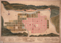 Mapa Ciudad de Cordoba 1802.png 4,846 × 3,480; 35.82 MB
-
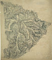
 Matto Grosso - 2 (2), Acervo do Museu Paulista da USP.jpg 5,412 × 7,216; 26.61 MB
-
 Nepaul valley map 1802.jpg 3,012 × 2,916; 2.2 MB
-
 Nicolas-Antoine Nouet, Carte de la Basse Egypte (FL25570241 2500767).jpg 16,783 × 15,742; 336.11 MB
-
 Nuova carta dellItalia (5376030500).jpg 778 × 1,024; 757 KB
-
 Ordnance Survey Drawings - Ashburton (OSD 25).jpg 3,441 × 4,000; 5.22 MB
-
 Ordnance Survey Drawings - Burnham on Sea (OSD 43-2).jpg 1,994 × 4,000; 2.4 MB
-
 Ordnance Survey Drawings - Cullompton (OSD 41-2).jpg 2,480 × 4,000; 4.74 MB
-
 Ordnance Survey Drawings - Dartmoor (OSD 23).jpg 4,000 × 1,937; 3.16 MB
-
 Ordnance Survey Drawings - Dunster (OSD 42-2).jpg 2,512 × 4,000; 4.43 MB
-
 Ordnance Survey Drawings - Lydeard, St. Lawrence (OSD 43-1).jpg 2,404 × 4,000; 3.64 MB
-
 Ordnance Survey Drawings - Milverton (OSD 44-1).jpg 2,656 × 4,000; 5.05 MB
-
 Ordnance Survey Drawings - Minehead (OSD 42-1).jpg 2,519 × 4,000; 4.59 MB
-
 Ordnance Survey Drawings - Taunton (OSD 44-2).jpg 2,407 × 4,000; 4.45 MB
-
 Ordnance Survey Drawings - Tavistock (OSD 27).jpg 4,000 × 2,597; 3.6 MB
-
 Ordnance Survey Drawings - Tor Bay (OSD 38).jpg 4,000 × 3,391; 4.96 MB
-

-
 Partie de la Valteline et frontiere de l' Italie. NYPL3979950.tiff 8,984 × 6,732, 2 pages; 173.31 MB
-
 Partie des Grisons de la Valteline. NYPL3979946.tiff 8,984 × 6,732, 2 pages; 173.31 MB
-
 Partie des Grisons du haut Rheinthal et ses frontieres au Gouvernement d' Arlberg et Tyrol. NYPL3979942.tiff 8,984 × 6,732, 2 pages; 173.31 MB
-
 Partie du Bas Vallais et le versant des eaux du Piemont. NYPL3979948.tiff 8,984 × 6,732, 2 pages; 173.31 MB
-
 Partie du C'ton du Vallais du Departement du Mont Blanc. NYPL3979947.tiff 8,984 × 6,732, 2 pages; 173.31 MB
-
 Partie du Canton de Berne de Soleure et de Fribourg. NYPL3979940.tiff 8,984 × 6,732, 2 pages; 173.31 MB
-
 Partie du Canton de Berne du Vallais et Canton de Fribourg. NYPL3979944.tiff 8,984 × 6,732, 2 pages; 173.31 MB
-
 Partie du Canton de Lucerne d'Unterwalden d'Uri et Zurich le Canton Glarus Schweiz et Zug. NYPL3979941.tiff 8,984 × 6,732, 2 pages; 173.31 MB
-
 Partie du Ct. Sentis et Autriche anterieure. NYPL3979938.tiff 8,984 × 6,732, 2 pages; 173.31 MB
-
 Pendleton-1802.jpg 1,869 × 1,212; 1,013 KB
-
 Pendleton-1802.PNG 3,738 × 2,424; 209 KB
-
 Perrier, CARTE DE L'ISTRIE ET DE LA DALMATIE (FL159663744 2591071).jpg 16,028 × 12,279; 240.08 MB
-
 Plan Jean Paris 16e.jpg 342 × 617; 245 KB
-

-
 Plan Wyborga 1802.jpeg 17,160 × 11,022; 16.36 MB
-
 Samuel John Neele, Map of Canaan or the Holy Land (FL6879605 2370330).jpg 3,440 × 5,208; 26.62 MB
-

-
 Utica in 1802. NYPL434566.tiff 4,858 × 5,035; 69.99 MB
-
 Vinkrath1802(TrK34-Grefrath).jpg 1,328 × 747; 251 KB

.jpg)


.jpg)
.jpg)

_auch_Polynesien_oder_Inselwelt,_insgemein_der_f%C3%BCnfte_Welttheil_genannt_-_UvA-BC_OTM_HB-KZL_69_11_05.jpg)


_p_3.jpg)


.jpg)
.jpg)
.jpg)
.jpg)
.jpg)
.jpg)
.jpg)
.jpg)
.jpg)
.jpg)
-(800x554).jpg)
.jpg)


.jpg)


.jpg)

,_Acervo_do_Museu_Paulista_da_USP.jpg)

.jpg)
.jpg)
.jpg)
.jpg)
.jpg)
.jpg)
.jpg)
.jpg)
.jpg)
.jpg)
.jpg)
.jpg)
.jpg)


.jpg)


.jpg)

.jpg)
.jpg)