Category:1810 maps of South America
Temperate regions: North America · South America · Africa · Europe · Asia · – Polar regions: – Other regions:
| ← 1810 1811 1812 1814 1816 1817 1818 → |
Media in category "1810 maps of South America"
The following 5 files are in this category, out of 5 total.
-
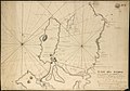
 Chart of Tierra del Fuego and the Strait of Magellan (4232065180).jpg 2,000 × 1,428; 2.08 MB
-
 Il Chili, regno dell'America meridionale - btv1b8441073c.jpg 4,918 × 6,737; 4.92 MB
-
-
 Planta da Cidade de S. Paulo (1810).jpg 5,444 × 4,172; 1.79 MB
-
 Planta da cidade de São Paulo, 1810.jpg 1,343 × 1,011; 943 KB
.jpg)

da_la_Poblacion_de_Talcaguano_en_la_latitud_S._de_36%E2%81%B0,42,28%22_y_en_longitud_al_O_de_cadiz_de_67%E2%81%B0,2,53%22_(4232064876).jpg)
.jpg)
