Category:1814 maps of Ohio
States of the United States: Iowa · Louisiana · Maryland · Massachusetts · Missouri · Ohio · Pennsylvania
| 1813 1814 1815 1817 → |
Media in category "1814 maps of Ohio"
The following 7 files are in this category, out of 7 total.
-
 Ketch map of Camp Meigs by Eliza Clay, 1814.jpg 5,600 × 7,664; 5.09 MB
-
 Ohio. LOC 2011585862.jpg 2,355 × 1,800; 703 KB
-
 Ohio. LOC 2011585862.tif 2,355 × 1,800; 12.13 MB
-
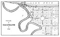 Spafford-Kelley map - Cleveland 1814.jpg 1,610 × 1,003; 402 KB
-
 The State of Ohio, with part of Upper Canada, etc NYPL1404001.tiff 6,366 × 4,380; 79.78 MB
-
 The State of Ohio, with part of Upper Canada, etc. LOC 2011585867.jpg 4,387 × 4,608; 2.8 MB
-
 The State of Ohio, with part of Upper Canada, etc. LOC 2011585867.tif 4,387 × 4,608; 57.84 MB


