Category:1820 maps of North America
Temperate regions: North America · South America · Africa · Europe · Asia · – Polar regions: – Other regions:
English: 1820 maps of North America
Subcategories
This category has only the following subcategory.
U
Media in category "1820 maps of North America"
The following 13 files are in this category, out of 13 total.
-

-
 A plan of the parish of St. Patrick in the island of Grenada. LOC 2001622464.jpg 4,881 × 3,943; 1.38 MB
-
 A plan of the parish of St. Patrick in the island of Grenada. LOC 2001622464.tif 4,881 × 3,943; 55.06 MB
-

-

-
 Carte de lile de Cuba (4587170964).jpg 2,000 × 1,369; 1.88 MB
-

-

-
 Non-Native Nations Claim over NAFTA countries 1820.png 800 × 895; 179 KB
-
 Nord America - entworfen und gezeichnet von C.F. Weiland. NYPL434868.tiff 4,968 × 5,995; 85.22 MB
-
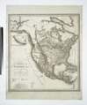
 Nord America (NYPL b15390304-434868).jpg 4,968 × 5,995; 7.12 MB
-
 Old maps of Hispaniola - 1820 - 001.jpg 15,875 × 10,298; 21.94 MB
-


.jpg)


.jpg)

.jpg)