Category:1824 maps of Europe
Temperate regions: North America · South America · Africa · Europe · Asia · – Polar regions: – Other regions:
English: 1824 maps of Europe
Español: Mapas de Europa en 1824
Suomi: Euroopan kartat vuodelta 1824
Română: Hărți ale Europei din 1824
Subcategories
This category has the following 8 subcategories, out of 8 total.
Media in category "1824 maps of Europe"
The following 10 files are in this category, out of 10 total.
-
 Extrait de plan de Perros-Hamon 1824.jpg 2,294 × 1,562; 186 KB
-
 Extrait du plan de réunion de Paimpol et Lanvignec 1824.png 2,420 × 1,744; 1.13 MB
-

-

-

-
 Plan de la Ville Uleåborg 1824.jpg 10,176 × 8,166; 9.22 MB
-
 Plan de Lannévez 1824.jpg 2,233 × 1,955; 255 KB
-
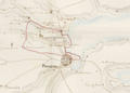
 Plan de Ploubazlanec Lannévez Perros-Hamon 1824.jpg 8,541 × 5,670; 2.05 MB
-
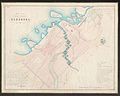
 Plan réunion de Paimpol et Lanvignec 1824.png 7,137 × 4,961; 5.06 MB
-


