Category:1827 maps of South America
Temperate regions: North America · South America · Africa · Europe · Asia · Oceania – Polar regions: – Other regions:
| 1820 1821 1822 1823 1824 1825 1826 1827 1828 1829 → |
Media in category "1827 maps of South America"
The following 6 files are in this category, out of 6 total.
-
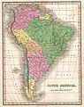 1827 Finley Map of South America - Geographicus - SouthAmerica-finley-1827.jpg 2,377 × 3,000; 2.06 MB
-
 Geographical, statistical, and historical map of Brazil LOC 2003627065.jpg 6,689 × 5,304; 6.27 MB
-
 Geographical, statistical, and historical map of Brazil LOC 2003627065.tif 6,689 × 5,304; 101.5 MB
-

-
 Peru LOC 2002624025.jpg 6,480 × 5,220; 5.54 MB
-
 Peru LOC 2002624025.tif 6,480 × 5,220; 96.78 MB


