Category:1828 maps of the United States
Subcategories
This category has the following 5 subcategories, out of 5 total.
Media in category "1828 maps of the United States"
The following 18 files are in this category, out of 18 total.
-

-

-

-

-
 Map of the city of Washington LOC 88694088.jpg 6,224 × 4,785; 3.92 MB
-
 Map of the city of Washington LOC 88694088.tif 6,224 × 4,785; 85.21 MB
-
-

-
 Map of the United States of North America (9471060537).jpg 800 × 677; 119 KB
-
 Map of Vermont & New Hampshire. LOC 2008624079.jpg 7,560 × 8,923; 11.58 MB
-
 New England. NYPL1260606.tiff 3,863 × 4,760; 52.61 MB
-
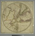
 New York und Umgebungen. NYPL1030054.tiff 2,850 × 2,033; 16.58 MB
-
 New York. NYPL433656.tiff 4,880 × 3,862; 53.93 MB
-
 Map of the United States (NYPL b15110717-434878).jpg 4,776 × 5,491; 5.37 MB
-
 Map of the United States (NYPL b15110717-434878).tiff 4,776 × 5,491; 75.04 MB
-

-
 Virginia, Maryland, and Delaware - J. Knight sc. NYPL433654.tiff 4,788 × 3,911; 53.58 MB
-
 White, Gallaher & White Mapa de los Estados Unidos de Méjico 1828 UTA.jpg 5,510 × 3,949; 22.67 MB
_Indians_in_1828._LOC_2008622050.jpg)

.jpg)
.jpg)

.jpg)
