Category:1840s maps of Japan
Countries of Asia: Afghanistan · Armenia‡ · Azerbaijan‡ · People's Republic of China · Cyprus‡ · Egypt‡ · Georgia‡ · India · Indonesia‡ · Iran · Iraq · Japan · Lebanon · Pakistan · Philippines · Russia‡ · Syria · Turkey‡ · Turkmenistan · Uzbekistan
Limited recognition: Abkhazia‡ · Taiwan · State of Palestine
‡: partly located in Asia
Limited recognition: Abkhazia‡ · Taiwan · State of Palestine
‡: partly located in Asia
Subcategories
This category has the following 5 subcategories, out of 5 total.
- 1846 maps of Japan (1 F)
Media in category "1840s maps of Japan"
The following 17 files are in this category, out of 17 total.
-
 Geographical map of Kōzuke Province (14802632102).jpg 2,441 × 2,000; 2.7 MB
-
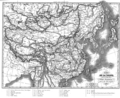
 Carte de l'empire chinois et du Japon LOC 2006629399.jpg 10,586 × 8,087; 15.48 MB
-
 Carte de l'empire chinois et du Japon LOC 2006629399.tif 10,586 × 8,087; 244.93 MB
-
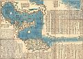
 Itinerary map of great Japan for a quick glance.jpg 2,500 × 792; 1.14 MB
-

-
 Plan of Nara, Yamato Province.jpg 2,500 × 1,933; 2.14 MB
-

-
 Map of the area along the Yodo river (14958880661).jpg 1,284 × 2,000; 1.21 MB
-
-
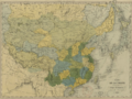 Carte de la Chine et des Etats-Tributaires.png 1,161 × 866; 2.28 MB
-
 Chinese empire and Japan. LOC 2006629414.jpg 5,783 × 4,879; 4.99 MB
-
 Chinese empire and Japan. LOC 2006629414.tif 5,783 × 4,879; 80.72 MB
-
 Empires chinois et japonais LOC 2006629415.jpg 6,400 × 4,822; 5.51 MB
-
 Empires chinois et japonais LOC 2006629415.tif 6,400 × 4,822; 88.29 MB
-
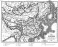 Evariste Huc carte voyage clear.png 903 × 734; 549 KB
-
 Evariste Huc carte voyage.png 903 × 734; 677 KB
-
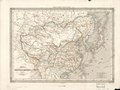
 Qing China 1844.png 903 × 685; 1.37 MB
.jpg)


_und_das_Kaiserthum_Japan.jpg)
.jpg)
_-_Geographicus_-_IsuIslands-japanese-1730.jpg)


