Category:1840s maps of Serbia
Countries of Europe: Albania · Armenia‡ · Austria · Azerbaijan‡ · Belarus · Belgium · Bosnia and Herzegovina · Bulgaria · Croatia · Cyprus‡ · Czech Republic · Denmark · Finland · France‡ · Georgia‡ · Germany · Greece · Hungary · Republic of Ireland · Italy · Lithuania · Netherlands‡ · Norway · Poland · Portugal‡ · Romania · Russia‡ · Serbia · Slovakia · Slovenia · Spain‡ · Sweden · Switzerland · Turkey‡ · Ukraine · United Kingdom
Limited recognition: Abkhazia‡
‡: partly located in Europe
Limited recognition: Abkhazia‡
‡: partly located in Europe
Media in category "1840s maps of Serbia"
The following 5 files are in this category, out of 5 total.
-
 Neueste Special & Kriegs-Karte der Europäischen Türkey in IV Blättern - Western Balkan.jpg 11,510 × 9,082; 22.51 MB
-
 Novi sad map 1845.jpg 2,106 × 2,670; 3.08 MB
-
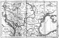 Balkankarte-1848.jpg 4,252 × 2,736; 7.52 MB
-

-
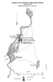 Map of the Battle of Perlasz (2 September 1848).png 1,728 × 2,649; 1.22 MB


.png)