Category:1843 maps of Africa
Temperate regions: North America · South America · Africa · Europe · Asia · – Polar regions: – Other regions:
| ← 1840 1841 1842 1843 1844 1845 1846 1847 1848 1849 → |
Subcategories
This category has the following 4 subcategories, out of 4 total.
A
- 1843 maps of Algeria (4 F)
L
- 1843 maps of Libya (1 F)
M
- 1843 maps of Morocco (2 F)
T
- 1843 maps of Tunisia (6 F)
Media in category "1843 maps of Africa"
The following 18 files are in this category, out of 18 total.
-

-
 ARROWSMITH(1843) Map of the West Coast of Africa (14773125342).jpg 3,364 × 2,152; 1.04 MB
-
 GRAVIER(1896) p309 Carte de 1843.jpg 1,504 × 2,618; 1.62 MB
-
 Afrique - DPLA - ba4f602d027caba9810d3c4d30b35ade.jpg 1,000 × 831; 192 KB
-
 Afrique - par A.-H. Dufour - btv1b8469055g.jpg 10,114 × 7,387; 8.68 MB
-
 Carte d'Afrique - dressée par A.-H. Dufour - btv1b53088688m.jpg 10,504 × 7,571; 11.28 MB
-

-
 Chart of a Part of the West Coast of Africa - NARA - 6860542.jpg 3,150 × 1,770; 2 MB
-
 Karte der Länder am Tumat und blauen Flusse.jpg 9,197 × 6,905; 11.14 MB
-
 Karte Von Ost Sudan.jpg 9,203 × 6,944; 13.12 MB
-

-

-

-

-

-
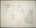
 The River Niger shewing the course of the expedition under Captain Trotter in 1841. RMG F0265.tiff 6,000 × 7,370; 126.51 MB
-
 Track of the Bittern on African slavery patrol RMG D7226 2.jpg 967 × 1,280; 715 KB
-
 Track of the Bittern on African slavery patrol RMG F0458.tiff 5,436 × 7,260; 112.91 MB
_Liberia_on_an_enlaged_scale_-_cropped_-_from_Map_of_the_West_Coast_of_Africa_(14773125342).jpg)
_Map_of_the_West_Coast_of_Africa_(14773125342).jpg)
_p309_Carte_de_1843.jpg)


