Category:1850s maps of the Near East
Media in category "1850s maps of the Near East"
The following 12 files are in this category, out of 12 total.
-

-
 1851 Henry Warren Map of Syria (cropped).jpg 3,162 × 4,413; 12.73 MB
-
 Bible dictionary for the use of Bible classes, schools and families (1851) (14597207628).jpg 2,448 × 4,020; 1.95 MB
-
 Martin, R.M.; Tallis, J. & F. Turkey in Asia. 1851 (A).jpg 3,958 × 3,137; 3.66 MB
-
 Martin, R.M.; Tallis, J. & F. Turkey in Asia. 1851 (D).jpg 2,755 × 1,606; 1.45 MB
-
 Martin, R.M.; Tallis, J. & F. Turkey in Asia. 1851.jpg 4,700 × 3,750; 3.74 MB
-
-
 Die Asiatische Türkei, die Kaukasusländer und West-Persien von H. Kiepert.jpg 8,277 × 6,713; 20.61 MB
-
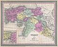
 1855 Colton Map of Turkey, Iraq, and Syria - Geographicus - TurkeyIraq-colton-1855.jpg 3,500 × 3,034; 3.22 MB
-
 Colton, G.W. Turkey In Asia And The Caucasian Provinces Of Russia. 1856 (A).jpg 4,858 × 4,206; 6.06 MB
-
 Colton, G.W. Turkey In Asia And The Caucasian Provinces Of Russia. 1856.jpg 5,970 × 5,650; 7.56 MB
-
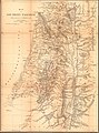 KiepertSouthernPalestine1856.jpg 4,522 × 6,119; 12.29 MB

.jpg)
_(14597207628).jpg)
.jpg)
.jpg)

_-_Geographicus_-_TurkeyAsia-mitchell-1850.jpg)


.jpg)

