Category:1850s maps of the world
| 19th-century maps of the world: ← 1800s 1810s 1820s 1830s 1840s 1850s 1860s 1870s 1880s 1890s → |
English: This category is supposed to hold world maps created in the 1850s.
Subcategories
This category has the following 7 subcategories, out of 7 total.
- 1855 maps of the world (2 F)
- 1856 maps of the world (2 F)
1
- 1850 maps of the world (3 F)
- 1858 maps of the world (2 F)
Media in category "1850s maps of the world"
The following 53 files are in this category, out of 53 total.
-
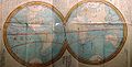
 Planisphere - Victor Levasseur.jpg 11,228 × 8,279; 29.3 MB
-
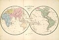
 1852 Levasseur Map of the World - Geographicus - Planisphere-levasseur-1852.jpg 3,000 × 2,181; 2.29 MB
-
 1852 Levasseur Map of the World - Geographicus - Planisphere-levasseur-1853.jpg 3,500 × 2,527; 3.33 MB
-
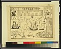
 1853 Kaei 6 Japanese Map of the World - Geographicus - ChikyuBankokuHozu-nakajima-1853.jpg 6,000 × 3,492; 5.51 MB
-
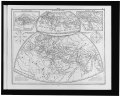
 1853 Outline of the geology of the globe.jpg 10,424 × 7,880; 9.51 MB
-
 The World, on Mercator's Projection by David H. Burr.jpg 8,000 × 6,356; 11.94 MB
-
 A & C Black 1854 Chart of the World.jpg 3,000 × 4,977; 2.3 MB
-

-

-
 1856 Desilver Map of the World - Geographicus - World-desilver-1856.jpg 3,500 × 2,374; 2.35 MB
-
 First Lesson in Geography Image5.png 845 × 541; 392 KB
-
 MALTE-BRUN(1856) 1.024 PLANISPHERE - LE MONDE.jpg 3,125 × 2,493; 4.11 MB
-
 (1857) Map of THE WORLD.jpg 4,493 × 2,785; 2.34 MB
-
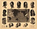
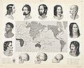
 T.V.(1857) - (6) MAPA-MUNDI ETNOGRAFICO DEL GLOBO.jpg 4,151 × 3,087; 5.98 MB
-
-

-
-

-
 CONRAD(1859) p715 WERELDKAART AAN HET EIND.jpg 4,191 × 3,381; 5.57 MB
-
 1859 Delamarche Case Map of the World - Geographicus - World-delamarche-1859.jpg 6,000 × 4,146; 6.65 MB
-

-

-

-

-

-

-

-

-
 Bankoku sankai tsuran bunzu LCCN2002700120.jpg 4,487 × 3,596; 1.79 MB
-
 Belgique horticole (10329384363).jpg 1,314 × 2,206; 608 KB
-
 Belgique horticole (Page 168, Plate 27) BHL42945913.jpg 2,627 × 4,412; 1.26 MB
-
 Humboldt's System of Isothermal Lines, or Lines of Equal Annual Mean Temperature Over the Globe.jpg 15,045 × 12,666; 32.85 MB
-
 Iconographic Encyclopedia of Science, Literature and Art 040.jpg 2,304 × 2,860; 1.02 MB
-
 Iconographic Encyclopedia of Science, Literature and Art 041.jpg 2,860 × 2,304; 1.48 MB
-
 Iconographic Encyclopedia of Science, Literature and Art 062.jpg 2,811 × 2,318; 1.18 MB
-
 Iconographic Encyclopedia of Science, Literature and Art 141.jpg 2,854 × 2,268; 1,016 KB
-
 Iconographic Encyclopedia of Science, Literature and Art 173.jpg 2,870 × 2,294; 1.05 MB
-
 ManjiroMap.jpg 1,131 × 576; 113 KB
-
 Mankind1ma6.jpg 1,160 × 951; 187 KB
-

-

-

-
-
 Maps of the world) - J.L. v. Bachr' sculpt LCCN95522154.jpg 4,096 × 3,275; 1.85 MB
-
 Maps of the world) - J.L. v. Bachr' sculpt LCCN95522154.tif 4,096 × 3,275; 12.79 MB
-
 Meyer‘s Zeitungsatlas 088 – Karte der magnetischen Meridiane und Parallel-Kreise.jpg 7,393 × 6,265; 11.9 MB
-
 Meyer‘s Zeitungsatlas 089 – Windkarte der Erde.jpg 7,393 × 6,258; 10.94 MB
-
 Meyer‘s Zeitungsatlas 090 – Hyetographische Karte der Erde.jpg 7,344 × 6,238; 18.3 MB
-
-
 Meyer‘s Zeitungsatlas 093 – Die Isothermkurven der Nördlichen Halbkugel.jpg 7,240 × 6,210; 12.99 MB
-
 Meyer‘s Zeitungsatlas 096 – Umrisse der Pflanzengeographie.jpg 7,219 × 6,238; 13.14 MB
-
 Newly revised Map of the earth (15032957242).jpg 2,500 × 1,140; 1.01 MB
-


_-_Geographicus_-_World-colton-1852.jpg)


_1.024_PLANISPHERE_-_LE_MONDE.jpg)
_Map_of_THE_WORLD.jpg)
_-_(6)_MAPA-MUNDI_ETNOGRAFICO_DEL_GLOBO.jpg)


.jpg)
.jpg)
_p715_WERELDKAART_AAN_HET_EIND.jpg)

.jpg)
.jpg)
.jpg)
.jpg)
.jpg)
.jpg)
.jpg)
.jpg)

.jpg)
_BHL42945913.jpg)


_-_J.L._v._Bachr%27_sculpt_LCCN95522154.jpg)


.jpg)
