Category:1851 maps of Massachusetts
States of the United States: California · Georgia · Massachusetts · New Mexico · New York · Ohio · Rhode Island · Texas · Utah – Washington, D.C.
| ← 1850 1851 1852 1853 1854 1855 1856 1857 1858 1859 → |
Media in category "1851 maps of Massachusetts"
The following 12 files are in this category, out of 12 total.
-
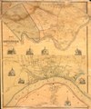
 1851 map Gloucester RockportMA byHFWalling BPL M8699.png 866 × 649; 1,019 KB
-
 Map of Springfield, Massachusetts (2674584595).jpg 2,000 × 1,931; 3.53 MB
-
 Map of the city of Salem, Mass. (7557390952).jpg 6,502 × 6,674; 39.39 MB
-
 Map of the town of Dedham, Norfolk County, Massachusetts (3370515080).jpg 1,715 × 2,000; 3.66 MB
-
 Map of the town of Haverhill, Essex County, Mass. (3369703211).jpg 1,613 × 2,000; 3.11 MB
-
 Map of the town of Haverhill, Essex County, Mass. LOC 2004631170.jpg 8,739 × 10,502; 13.8 MB
-
 Map of the town of Haverhill, Essex County, Mass. LOC 2004631170.tif 8,739 × 10,502; 262.58 MB
-
 Map of the town of Upton, Worcester Co., Mass. (3719858991).jpg 712 × 1,024; 590 KB
-
 Massachusetts map by George W. Boynton, 1851.jpg 3,969 × 2,885; 4.67 MB
-

-

-
 Signage at Salem station (15), December 2018.jpg 5,472 × 3,648; 5.05 MB

.jpg)
.jpg)
.jpg)
.jpg)

.jpg)

.jpg)
_June_19_1851_at_4_o_clk_pm_on_the_premises_(9472266227).jpg)
,_December_2018.jpg)