Category:1852 maps of the United Kingdom
Countries of Europe: France‡ · Germany · Norway · Spain‡ · Switzerland · United Kingdom
‡: partly located in Europe
‡: partly located in Europe
Media in category "1852 maps of the United Kingdom"
The following 3 files are in this category, out of 3 total.
-
 Leeds town hall first drawing.jpg 500 × 251; 15 KB
-
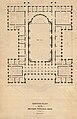 Leeds town hall original plan.jpg 500 × 775; 44 KB
-
 Map of England showing prevalence of cholera, 1849 Wellcome L0039174.jpg 3,760 × 4,653; 9.8 MB


