Category:1858 maps of Canada
| 1850 1851 1852 1853 1854 1855 1856 1857 1858 1859 → |
English: Maps of Canada from 1858 or related to Canada in 1858
Français : Les cartes du Canada de 1858 ou se rapportant au Canada en 1858
Subcategories
This category has the following 2 subcategories, out of 2 total.
O
Media in category "1858 maps of Canada"
The following 6 files are in this category, out of 6 total.
-

-
 (1858) Chart of Parts of the Arctic Regions - as known in 1845.jpg 3,733 × 2,344; 3.42 MB
-
 BC-New Eldorado.jpg 4,252 × 3,009; 2.47 MB
-
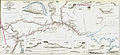 Map of Part of the Valley of Red River North of the 49th Parallel (1858).jpg 7,500 × 3,443; 5.5 MB
-
 Milton, Ontario in 1858.jpg 960 × 630; 96 KB
-


_Chart_of_Parts_of_the_Arctic_Regions_-_as_known_in_1845.jpg)

.jpg)

