Category:1866 maps of Europe
Temperate regions: North America · South America · Africa · Europe · Asia · – Polar regions: – Other regions:
English: 1866 maps of Europe
Español: Mapas de Europa en 1866
Suomi: Euroopan kartat vuodelta 1866
Română: Hărți ale Europei din 1866
Subcategories
This category has the following 10 subcategories, out of 10 total.
.
F
G
I
- 1866 maps of Italy (4 F)
N
- 1866 maps of Norway (8 F)
S
- 1866 maps of Spain (1 F)
U
- 1866 maps of Ukraine (3 F)
Media in category "1866 maps of Europe"
The following 10 files are in this category, out of 10 total.
-
 1866 carta di montaione.jpg 1,713 × 1,274; 567 KB
-

-

-
 General map of telegraph lines between Europe, India, Australia, and China. RMG F0302.tiff 7,199 × 5,329; 109.76 MB
-

-

-
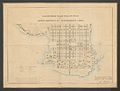 Projecterad Plan Till Ny Stad i Kemi socken af Uleåborgs län 1866.jpg 8,104 × 6,172; 33.24 MB
-
 Södra Djurgården 1866.jpg 7,296 × 4,592; 14 MB
-

-

%27_(11071192705).jpg)
.jpg)


.jpg)