Category:1870s maps of Central America
Subcategories
This category has the following 3 subcategories, out of 3 total.
Media in category "1870s maps of Central America"
The following 10 files are in this category, out of 10 total.
-
 1871 map of Central America showing its political divisions.jpg 3,008 × 2,636; 1.29 MB
-
 1874 Mitchell Map of North America ^ the United States - Geographicus - AmerNorth-m-1874.jpg 2,390 × 3,000; 2.52 MB
-

-

-

-
 The Collegiate Atlas 1876 (82452395).jpg 8,443 × 6,689; 6.19 MB
-

-
 Mittel-America und Westindien (3120220345).jpg 2,000 × 1,635; 2.94 MB
-

-
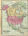 Noth America Map 1872.jpg 2,462 × 3,155; 10.06 MB


.jpg)
.jpg)
%27_(11114818123).jpg)
.jpg)

.jpg)
_(14779897521).jpg)
