Category:1870s maps of China
Countries of Asia: Afghanistan · Armenia‡ · Azerbaijan‡ · People's Republic of China · Cyprus‡ · Egypt‡ · Georgia‡ · India · Indonesia‡ · Iran · Iraq · Japan · Jordan · Lebanon · Pakistan · Philippines · Russia‡ · Syria · Turkey‡
Limited recognition: Abkhazia‡ · Taiwan · State of Palestine
‡: partly located in Asia
Limited recognition: Abkhazia‡ · Taiwan · State of Palestine
‡: partly located in Asia
Subcategories
This category has the following 11 subcategories, out of 11 total.
- 1870 maps of China (2 F)
- 1871 maps of China (1 F)
- 1873 maps of China (4 F)
- 1874 maps of China (3 F)
- 1875 maps of China (12 F)
- 1879 maps of China (2 F)
H
- Huangchao Zhisheng Diyu Quantu (38 F)
Media in category "1870s maps of China"
The following 12 files are in this category, out of 12 total.
-

-
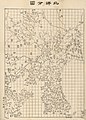 Bei yang fen tu. LOC gm71005226.jpg 5,184 × 7,236; 5.82 MB
-
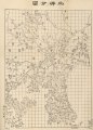 Bei yang fen tu. LOC gm71005226.tif 5,184 × 7,236; 107.32 MB
-
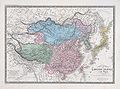
 1871 Russian map of Central Asia.jpg 15,486 × 10,689; 27.99 MB
-
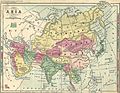 Asia 1870s Map.jpg 3,152 × 2,448; 3.72 MB
-

-
 Brue Atlas Universel.jpg 1,653 × 1,222; 1.03 MB
-
 15 of 'Guide for Tourists to Peking and its environs. With a plan, etc' (11113339503).jpg 4,643 × 4,400; 2.69 MB
-
 33 of 'Guide for Tourists to Peking and its environs. With a plan, etc' (11115208916).jpg 5,035 × 5,777; 3.78 MB
-

-
 Beijing 1878 DE.jpg 4,710 × 6,660; 5.49 MB
-
 Ajia tōbu yochizu (2676796880).jpg 2,000 × 1,367; 3.02 MB
.jpg)


.jpg)
.jpg)
.jpg)

.jpg)
%27_(11108143674).jpg)