Category:1870s maps of Rhode Island
States of the United States: Alabama · Alaska · Arkansas · California · Colorado · Connecticut · Delaware · Florida · Georgia · Hawaii · Idaho · Illinois · Indiana · Iowa · Kansas · Kentucky · Louisiana · Maine · Maryland · Massachusetts · Michigan · Minnesota · Mississippi · Missouri · Montana · Nebraska · Nevada · New Hampshire · New Jersey · New Mexico · New York · North Carolina · North Dakota · Ohio · Oklahoma · Oregon · Pennsylvania · Rhode Island · South Carolina · South Dakota · Tennessee · Texas · Utah · Vermont · Virginia · Washington · West Virginia · Wisconsin · Wyoming – Washington, D.C.
Puerto Rico
Puerto Rico
Subcategories
This category has the following 2 subcategories, out of 2 total.
Media in category "1870s maps of Rhode Island"
The following 6 files are in this category, out of 6 total.
-

-
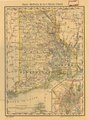
 1875 Rhode Island railroads map.jpg 3,080 × 4,160; 4.24 MB
-

-
-
 Map of the city of Providence, Rhode Island (3121050370).jpg 6,408 × 8,650; 6.13 MB
-
 Valley of Blackstone River within the state of Mass. (2675210470).jpg 1,668 × 2,000; 2.26 MB


.jpg)
.jpg)