Category:1870s maps of South America
Temperate regions: North America · South America · Africa · Europe · Asia · Oceania – Polar regions: – Other regions:
Subcategories
This category has the following 20 subcategories, out of 20 total.
- 1870 maps of South America (4 F)
- 1871 maps of South America (4 F)
- 1874 maps of South America (5 F)
- 1876 maps of South America (9 F)
- 1878 maps of South America (1 F)
- 1879 maps of South America (2 F)
A
- 1870s maps of Argentina (20 F)
B
- 1870s maps of Bolivia (9 F)
C
- 1870s maps of Chile (30 F)
- 1870s maps of Colombia (3 F)
E
- 1870s maps of Ecuador (12 F)
P
- 1870s maps of Paraguay (13 F)
- 1870s maps of Peru (13 F)
U
- 1870s maps of Uruguay (8 F)
V
- 1870s maps of Venezuela (5 F)
Media in category "1870s maps of South America"
The following 2 files are in this category, out of 2 total.
-
 Amérique equatoriale pour suivre les voyages du Dr Crevaux 1878-1879 - btv1b55010939p.jpg 4,106 × 2,763; 1.38 MB
-
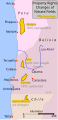 Saltpeter fields in 1876.svg 254 × 523; 56 KB

