Category:1870s maps of Sudan
Media in category "1870s maps of Sudan"
The following 7 files are in this category, out of 7 total.
-

-

-
 Expédition Prout. Carte de la route de El Obeiyad à El Facher.png 6,211 × 2,469; 16.55 MB
-
 Expédition Prout. Carte de la route de Souakin à Berber.png 6,351 × 4,097; 28 MB
-
 Expédition Prout. Foga à El Obeiyad.png 7,743 × 4,051; 28.73 MB
-
 Expédition Prout. Province of Kordofan.png 5,277 × 5,671; 36.41 MB
-
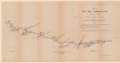
 Expédition Prout. Route de Khartoum à Obeiyad.png 4,895 × 5,728; 27.82 MB
.jpg)


