Category:1874 maps of Texas
States of the United States: California · Illinois · Massachusetts · Michigan · New Hampshire · New York · Ohio · Pennsylvania · Texas · Utah · Vermont
| ← 1871 1872 1874 1875 1876 1877 1878 1879 → |
Media in category "1874 maps of Texas"
The following 5 files are in this category, out of 5 total.
-
 Asher & Adams' Texas (Western Portion) 1874 UTA.jpg 5,159 × 6,932; 8.3 MB
-
 Rockwall Co. LOC 2012590078.jpg 6,008 × 7,612; 5.81 MB
-
 Rockwall Co. LOC 2012590078.tif 6,008 × 7,612; 130.84 MB
-
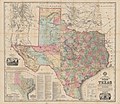 Roessler Latest Map of the State of Texas 1874 UTA.jpg 2,838 × 2,459; 8.37 MB
-

_1874_UTA.jpg)


_-_DPLA_-_eab9cf18db1a3d9623a1747e0b952dbf.jpg)