Category:1874 maps of the world
Media in category "1874 maps of the world"
The following 11 files are in this category, out of 11 total.
-

-

-

-

-

-

-
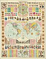 Bacon's Pictorial View of the World.jpg 18,717 × 23,860; 124.6 MB
-
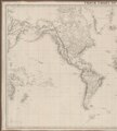 Admiralty Chart No 2558 Track chart of the world - Western Sheet, Published 1874.tiff 8,209 × 9,159; 215.13 MB
-
 Admiralty Chart No 2558 Track chart of the world - Eastern Sheet, Published 1874.tiff 7,806 × 9,128; 203.88 MB
-
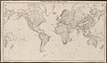 Admiralty Chart No 2558 Track chart of the world, Published 1874.jpg 15,560 × 9,183; 40.24 MB
-
 PSM V06 D237 Earth as seen from the sun in two consecutive days.jpg 1,685 × 843; 265 KB
.jpg)
.jpg)
.jpg)
.jpg)
.jpg)
.jpg)


