Category:1880s maps of the Atlantic Ocean
Media in category "1880s maps of the Atlantic Ocean"
The following 30 files are in this category, out of 30 total.
-

-
 210 of 'Physiography ... New edition' (11286343634).jpg 1,235 × 891; 234 KB
-
 Admiralty Chart No 1 British Islands to the Mediterranean Sea, Published 1884.jpg 8,151 × 12,101; 26.85 MB
-
 Meyers b2 s0003 b2.png 380 × 460; 87 KB
-
 Meyers b2 s0003 b3.png 380 × 460; 86 KB
-

-

-
-

-

-

-

-

-

-
-
 491 of 'Illustreret Norges historie. (With plates.)' (11287155886).jpg 1,362 × 958; 288 KB
-
 5 of 'To America and back- a holiday run' (11185371314).jpg 4,801 × 2,101; 1.68 MB
-

-

-

-
 Anales de la Sociedad Española de Historia Natural (1880) (18165919975).jpg 2,980 × 1,654; 966 KB
-
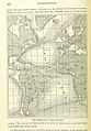
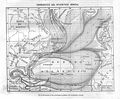
 Atlantic Ocean shewing the communication between Europe, and North America.png 2,863 × 1,506; 4.44 MB
-
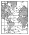
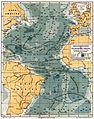
 Atlantikströmungen 1883.jpg 2,916 × 3,893; 4.14 MB
-
 Corrientes del Atántico norte.jpg 2,281 × 1,874; 882 KB
-
 Die Gartenlaube (1885) b 635 1.jpg 824 × 789; 172 KB
-
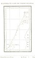
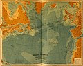
 FMIB 34605 Carte des Profondeurs de l'Atlantique.jpeg 738 × 1,098; 233 KB
-
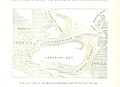
 FMIB 46914 Carte du voyage du Talisman en 1883.jpeg 787 × 656; 117 KB
-
 Meyers b2 s0001a.jpg 1,612 × 2,048; 519 KB
-
 Pilot chart of the North Atlantic Ocean 11-c.983-1885-s13100k.png 8,730 × 6,921; 173.17 MB
-
 The earth and its inhabitants (1881) (14782070654).jpg 2,912 × 2,330; 1.12 MB

.jpg)


.jpg)
.jpg)
.jpg)
.jpg)
.jpg)
.jpg)
.jpg)
.jpg)
.jpg)
.jpg)
%27_(11287155886).jpg)
.jpg)
.jpg)


_(18165919975).jpg)


_b_635_1.jpg)


_(14782070654).jpg)