Category:1884 maps of South Carolina
States of the United States: California · Connecticut · Delaware · Florida · Georgia · Idaho · Illinois · Indiana · Iowa · Kansas · Kentucky · Louisiana · Maine · Massachusetts · Michigan · Minnesota · Missouri · Montana · New Hampshire · New Jersey · New York · North Carolina · North Dakota · Ohio · Oregon · Pennsylvania · South Carolina · South Dakota · Tennessee · Texas · Utah · Vermont · Virginia · Washington · West Virginia · Wisconsin · Wyoming – Washington, D.C.
| 1883 1884 1886 1888 1889 → |
Subcategories
This category has the following 3 subcategories, out of 3 total.
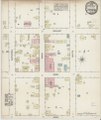
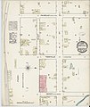
Media in category "1884 maps of South Carolina"
The following 50 files are in this category, out of 50 total.
-

-

-

-
 Sanborn Fire Insurance Map from Aiken, Aiken County, South Carolina. LOC sanborn08110 001.tif 6,450 × 7,650; 141.17 MB
-

-
 Sanborn Fire Insurance Map from Anderson, Anderson County, South Carolina. LOC sanborn08112 001.tif 6,450 × 7,650; 141.17 MB
-

-

-

-
 Sanborn Fire Insurance Map from Chester, Chester County, South Carolina. LOC sanborn08126 001.tif 6,450 × 7,650; 141.17 MB
-

-
-

-
 Sanborn Fire Insurance Map from Marion, Marion County, South Carolina. LOC sanborn08162 001.tif 6,450 × 7,650; 141.17 MB
-

-
 Sanborn Fire Insurance Map from Marion, Marion County, South Carolina. LOC sanborn08162 002-1.tif 6,450 × 7,650; 141.17 MB
-

-
 Sanborn Fire Insurance Map from Marion, Marion County, South Carolina. LOC sanborn08162 002-2.tif 6,450 × 7,650; 141.17 MB
-

-

-

-

-

-
 Sanborn Fire Insurance Map from Clinton, Laurens County, South Carolina. LOC sanborn08128 001.tif 6,450 × 7,650; 141.17 MB
-

-

-

-

-

-
 Sanborn Fire Insurance Map from Florence, Florence County, South Carolina. LOC sanborn08138 001.tif 6,450 × 7,650; 141.17 MB
-

-

-

-

-

-
 Sanborn Fire Insurance Map from Laurens, Laurens County, South Carolina. LOC sanborn08156 001.tif 6,450 × 7,650; 141.17 MB
-

-
 Sanborn Fire Insurance Map from Rock Hill, York County, South Carolina. LOC sanborn08177 001.tif 6,450 × 7,650; 141.17 MB
-
-
 Sanborn Fire Insurance Map from Seneca, Oconee County, South Carolina. LOC sanborn08181 001.tif 6,450 × 7,650; 141.17 MB
-

-

-

-
 Sanborn Fire Insurance Map from Union, Union County, South Carolina. LOC sanborn08188 001.tif 6,450 × 7,650; 141.17 MB
-

-
 Sanborn Fire Insurance Map from Walhalla, Oconee County, South Carolina. LOC sanborn08189 001.tif 6,450 × 7,650; 141.17 MB
-

-

-

-
 Sanborn Fire Insurance Map from York(ville), York County, South Carolina. LOC sanborn08197 001.tif 6,450 × 7,650; 141.17 MB


,_York_County,_South_Carolina._LOC_sanborn08197_001.jpg)